


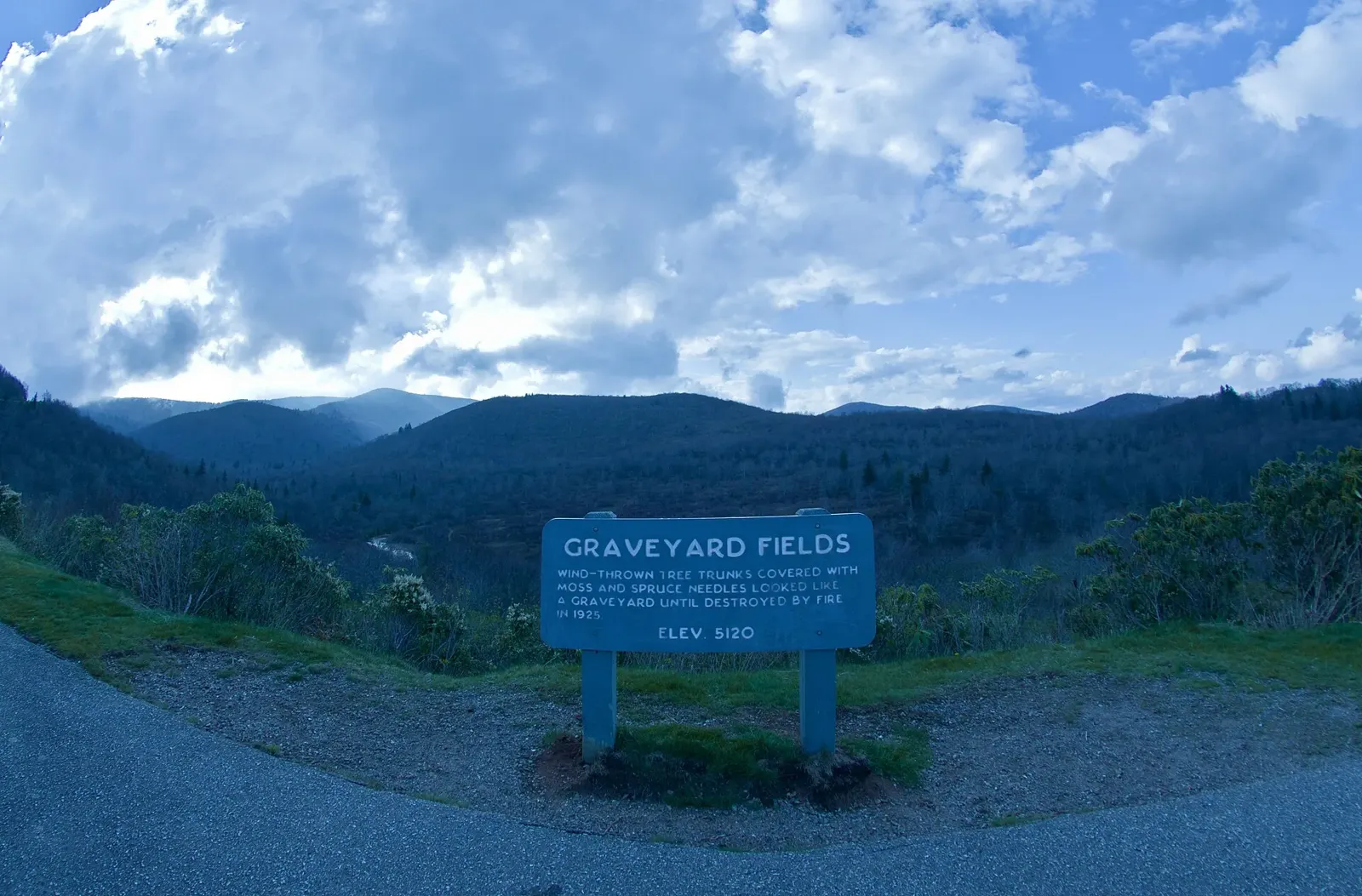
Graveyard Fields carries the strangest name on the Blue Ridge Parkway, and the valley earns every bit of the attention the name brings. Two waterfalls, an open meadow at about 5,120 feet and some of the earliest fall color in North Carolina wait below the overlook at milepost 418.8.
The Yellowstone Prong runs through the whole scene. This small, cold stream forms the headwaters of the East Fork of the Pigeon River, takes its name from the yellow lichens on its rocks and drops over Upper Falls and Second Falls inside one compact trail system.
Most Parkway hikes climb to a summit or follow a ridge through deep forest. This one drops into an open bowl that wind, logging and fire reshaped long ago, and the slow recovery still unfolds in plain sight. Drivers who want the full route context can start with our Blue Ridge Parkway road trip guide, and waterfall hunters can compare this stop with the rest in our Blue Ridge Parkway waterfalls roundup.
Why the Name Sounds So Grim
Centuries ago, a tremendous windstorm flattened the spruce forest that filled this valley. The fallen trunks rotted away over the years and left a field of dirt mounds and moss covered stumps, and early visitors thought the mounds looked like gravestones in a giant graveyard. The name stuck.
Logging crews reached the valley in the early 1900s and cut the chestnut and hardwood stands. Their work left fresh stumps across the fields, and moss soon covered those as well, so the graveyard look only grew stronger.
In 1925, a fire roared through the recently logged valley and burned more than 25,000 acres. The flames burned so deep that they cooked nutrients out of the soil, and trout anglers caught in the valley on opening day survived by lying in the pools of the Yellowstone Prong and lifting their heads for quick breaths of air.
The starved soil still slows the forest recovery a century later. Shrubs, blackberry canes and young trees creep back year by year, and the open meadow that remains gives this hike wide views, full sun and a famous blueberry crop.
Getting There and Parking Strategy
The Graveyard Fields overlook and parking lot sit at milepost 418.8 on the Blue Ridge Parkway, about 37 miles south of Asheville (see the National Park Service Graveyard Fields page). The drive takes about an hour, and most Asheville drivers enter the Parkway near milepost 382 and roll south past Mount Pisgah.
Drivers coming from Brevard climb US 276 to the Parkway entrance at milepost 412.2 and then follow the Parkway south to the lot. Either way, a big trail map sign and a pair of staircases mark the stop, and the lot works as an overlook even for visitors who never hike.
Parking decides how your visit starts, so plan it like part of the hike:
- The lot holds about 40 cars, and it fills by late morning from late spring through early fall
- Arrive before 9 a.m. on summer and October weekends, or aim for late afternoon after the day crowds leave
- Rangers ticket cars that overflow onto the grass and the Parkway shoulder inside the posted no parking zones, and they patrol this lot often
- Vault restrooms stand at the lot, a rare comfort on the Parkway, so use them before you drop to the trails
- Fill the gas tank and download your maps before you climb, because the Parkway has no gas stations and cell signals fade fast at this height
The Trails, Step by Step
Every trail here starts at one of two staircases below the parking lot. The staircase near the restrooms sends you toward Second Falls first, and most hikers run the loop counterclockwise from there.
- Drop down the staircase near the restrooms and follow the paved path through a thick tunnel of rhododendron to a footbridge over the Yellowstone Prong
- Cross the bridge and turn right to reach the Second Falls spur, then climb down long wooden stairs to the viewing platform and the pool at the base
- Climb back up, return to the junction and head left into the open meadow to start the loop itself
- Cross the valley floor on a worn, sunny path, pass the Graveyard Ridge Trail junction and keep the stream on your right
- Watch for the fork near Upper Falls and take the right branch to the main drop, where flat rocks give you room to sit and watch the water
- Return on the connector path, cross the Prong on a second wooden bridge and climb the upper staircase back to the far end of the parking lot
| Trail | Distance | Difficulty | Best for |
|---|---|---|---|
| Second Falls Spur | 0.6 mile round trip | Easy to moderate, with steep stairs | A quick waterfall stop and a summer swim |
| Graveyard Fields Loop | 3.2 miles | Moderate | The full tour of both falls and the open meadow |
| Upper Falls Route | About 3 miles round trip | Moderate, with mud and rocks near the top | Hikers who want the quieter falls as the main goal |
The full loop gains about 450 feet, and most hikers finish in two to three hours once they add waterfall stops and photo breaks. Strong walkers run it faster, and blueberry season slows everyone down in the best way.
Families rate this loop among the best first waterfall hikes near Asheville, because kids get two falls, a bridge and an open meadow inside one short route. Our Blue Ridge Parkway with kids guide lists more trails at this level, and our best hikes near Asheville list ranks it against other trails within an hour of town.
Second Falls and Upper Falls Compared
The two falls share one stream and draw very different crowds. Most visitors see only the first one, and the loop regulars argue the second one wins the day.
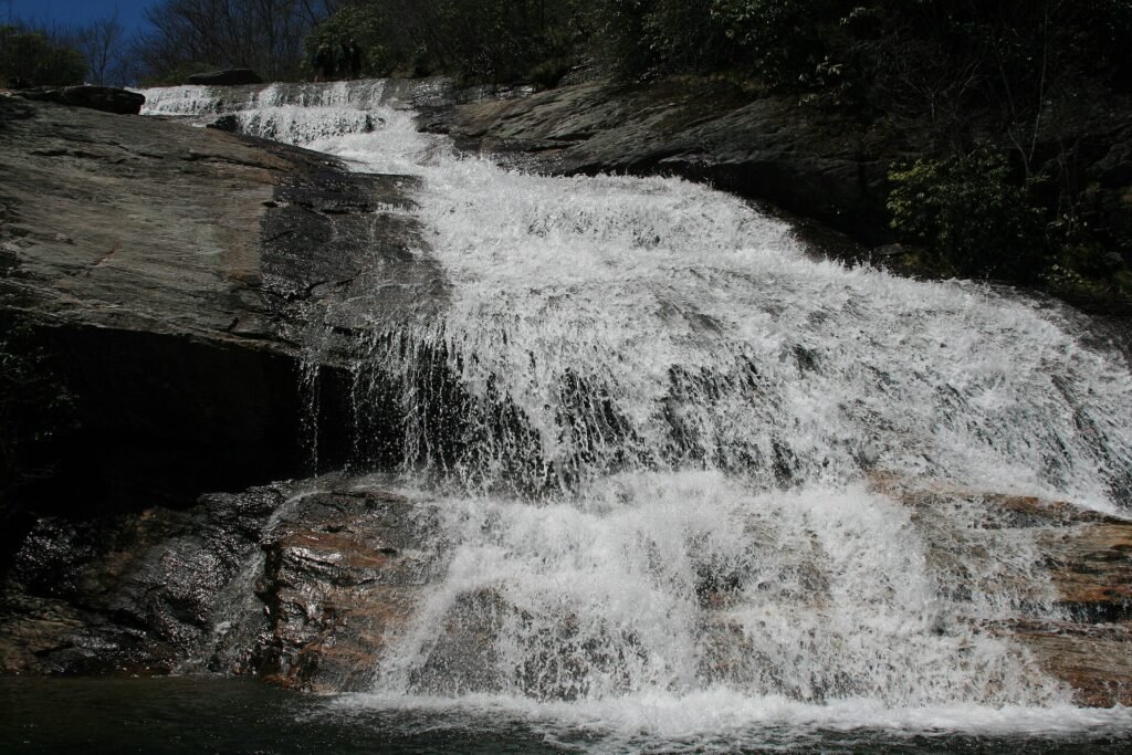
- Second Falls drops about 55 feet over a broad rock face and lands in a wide pool that swimmers claim all summer
- Trail signs at the junction call it Lower Falls, while maps and locals say Second Falls, because a third drop, Yellowstone Falls, sits farther downstream with no maintained trail to it
- Upper Falls stands about 40 feet tall and pours through a narrow chute of dark rock into a small, quiet clearing
- Second Falls wins on size, swimming and easy access, while Upper Falls wins on solitude and the long meadow walk that leads to it
- The path to Upper Falls grows rocky and muddy near the top, so the falls reward hikers who wear real shoes and watch their footing
Hurricane Helene shifted boulders at Second Falls in 2024, so the base looks a little different from older photos. Trail crews keep repairing storm damage across this area, and current conditions can change from month to month. If you want bigger water on the same trip north, Linville Falls and Crabtree Falls are the Parkway’s other headline waterfalls.
Blueberries in August
Blueberry bushes carpet the open valley, and the crop ripens around the middle of August in most years. Locals plan whole mornings around the harvest, and the patches near the loop trail draw steady crowds of pickers.
- Park Service rules let each person pick one gallon per day for personal use, so bring a bucket or a sturdy bag
- Arrive early in the season and early in the day, because the bushes closest to the trail thin out fast
- Leave fruit on every bush you pick, because birds and bears depend on the same crop
- Make noise as you move through the thickets, because black bears feed on these berries in August and prefer a warning over a surprise
- Eat a few on the trail if you like, but save the full gallon for home, since the rule covers picking for personal use only
Fall Color in Early October
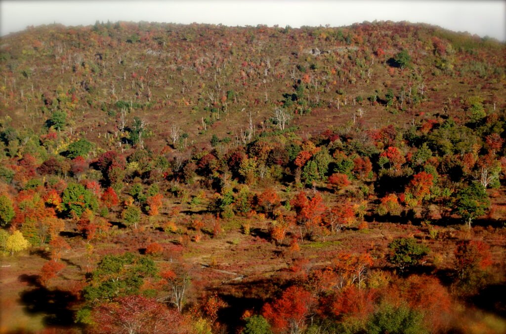
Cold nights reach this valley weeks before they reach Asheville, and Graveyard Fields often shows the first strong fall color in the region. Blueberry bushes turn deep crimson across the meadow floor while maples on the slopes above add orange and gold.
Peak color usually lands in the first two weeks of October. The open slopes turn the overlook into a color lookout as much as a trailhead, and photographers line the rail before breakfast on clear mornings. Our Blue Ridge Parkway fall colors guide shows how peak timing moves by elevation, and our list of the best Blue Ridge Parkway overlooks adds more sunrise spots nearby.
October weekends fill the lot faster than summer ones. The early arrival rule matters even more in color season, and weekday mornings give you the quietest version of this valley.
Safety and Mountain Weather
The parking lot sign reads 5,120 feet for a reason. Weather at this height plays by mountain rules, not Asheville rules, and hikers who dress for town often regret it by the first bridge.
- Temperatures often run 10 to 20 degrees cooler than Asheville, and wind races across the open valley with nothing to block it
- Summer storms build fast over the high peaks, and the open meadow offers no shelter, so head back toward the trees and the lot at the first thunder
- Wet rocks near both falls stay slick in every season, so step on dry stone, use the handrails on the stairs and keep kids close at the pools
- The Upper Falls path turns into mud after rain, and creek crossings on the loop rise fast after storms, so turn around when water covers the stepping stones
- Black bears roam this valley for the blueberry crop, so store all food in the car, keep your distance and never approach a bear for a photo
- Cell service drops out along much of this Parkway stretch, so tell someone your plan and snap a photo of the trail map at the lot before you start
Check the Blue Ridge Parkway real-time road closures page and the Pisgah National Forest alerts before you leave town. Ice, fallen trees and repair work close this Parkway section in any season, and winter closes it most often of all; our Blue Ridge Parkway in winter guide explains which stretches shut first.
A washed out forecast does not have to kill the trip. Our things to do in Asheville on a rainy day guide keeps a full backup plan waiting in town.
What to Pack
- Shoes with real tread, because mud and wet rock rule the Upper Falls path
- A warm layer and a rain shell, even on a sunny July morning
- More water than you expect to drink, because no water waits for you on the trail
- A bucket or sturdy bag in August, sized to the one gallon per person rule
- Sunscreen and a hat, because the meadow trail runs in full sun for long stretches
- A towel and dry socks in the car if you plan to swim at Second Falls
For a full seasonal list, see what to pack for Asheville.
Nearby Stops Worth Adding
Graveyard Fields sits in the richest short stretch of the southern Parkway, and three strong stops sit within a few miles. Any one of them pairs with the loop for a full high country day.
- Skinny Dip Falls at milepost 417: Park at the Looking Glass Rock Overlook, cross the Parkway and follow the Mountains to Sea Trail about 0.9 mile round trip to a chain of small falls about 30 feet tall in total and a deep swimming pool. Storm damage has reshaped this trail in recent years, so check its current status before you count on it
- Black Balsam Knob at milepost 420.2: Turn onto Black Balsam Road and climb the Art Loeb Trail about 1.4 miles round trip to a bare summit at 6,214 feet with views in every direction
- Devil’s Courthouse at milepost 422.4: A steep paved path climbs about 0.8 mile round trip to a rock summit at 5,720 feet, and clear days open views into four states. Peregrine falcons nest on these cliffs, so stay on the trail and give the birds their space
A Sample Half Day Plan
This plan starts early and puts you back on the road by lunch. Shift the times later outside summer, and always check the road status before you commit to the drive.
- 8:00 a.m. Leave Asheville with a full tank and drive the Parkway south past Mount Pisgah
- 9:00 a.m. Park at milepost 418.8, read the trail map sign and take the stairs down to reach Second Falls before the crowds
- 9:45 a.m. Swim or wade at the pool, then climb out and start the loop across the meadow
- 11:30 a.m. Reach Upper Falls, eat a snack on the flat rocks and start the return leg
- 12:45 p.m. Climb the upper staircase to the lot and eat a picnic lunch at the overlook
- 2:00 p.m. Add Black Balsam Knob or Devil’s Courthouse on the drive back toward town
Visitors who base in town can round out the same day with our 1 day in Asheville NC itinerary, or turn it into a longer trip with the 3 day Asheville itinerary.
FAQs
A windstorm flattened the spruce forest here centuries ago, and the moss covered stumps and dirt mounds that remained looked like gravestones in a huge graveyard. Logging and the great fire of 1925 kept the valley open, and the name stuck.
The full loop runs about 3.2 miles and covers both waterfalls and the open meadow. Most hikers need two to three hours with stops, and the short spur to Second Falls alone runs about 0.6 mile round trip.
Yes. The pool at the base of Second Falls ranks among the most popular swimming holes on the Parkway. No lifeguards watch the water, the stream runs cold all summer, and wet rocks around the pool demand care from everyone.
The crop usually ripens around the middle of August. Park Service rules let each person pick one gallon per day for personal use, and pickers who arrive early in the season find the fullest bushes.
Color usually peaks in the first two weeks of October, and this valley often turns before the lower slopes near Asheville. Blueberry bushes turn deep red across the meadow and add color even before the maples peak.
No. The Blue Ridge Parkway charges no entry fee and needs no pass, and parking and hiking at Graveyard Fields cost nothing at all.
Yes. Dogs can walk every trail here, and Park Service rules require a leash of six feet or shorter with the owner in control at all times.
The lot holds about 40 cars and fills by late morning from late spring through early fall. Arrive before 9 a.m. on summer and October weekends, or aim for late afternoon when the day crowds thin out.
Plan Your Graveyard Fields Trip
Pick a clear morning, start early and give the full loop your best hours. Graveyard Fields rewards the drive with two waterfalls, a wild open valley and a land story you can read in the meadow itself.
Go in August for blueberries, in October for color or in June for rhododendron bloom along the stream. Whatever month you choose, check the road and trail status before you leave, pack for colder air than town and let this strange, beautiful valley set the pace for your Parkway day.
Sources: National Park Service: Graveyard Fields; USDA Forest Service: Graveyard Fields Loop Trail; NPS Blue Ridge Parkway road closures. Conditions change after storms, so confirm trail status before you go.