


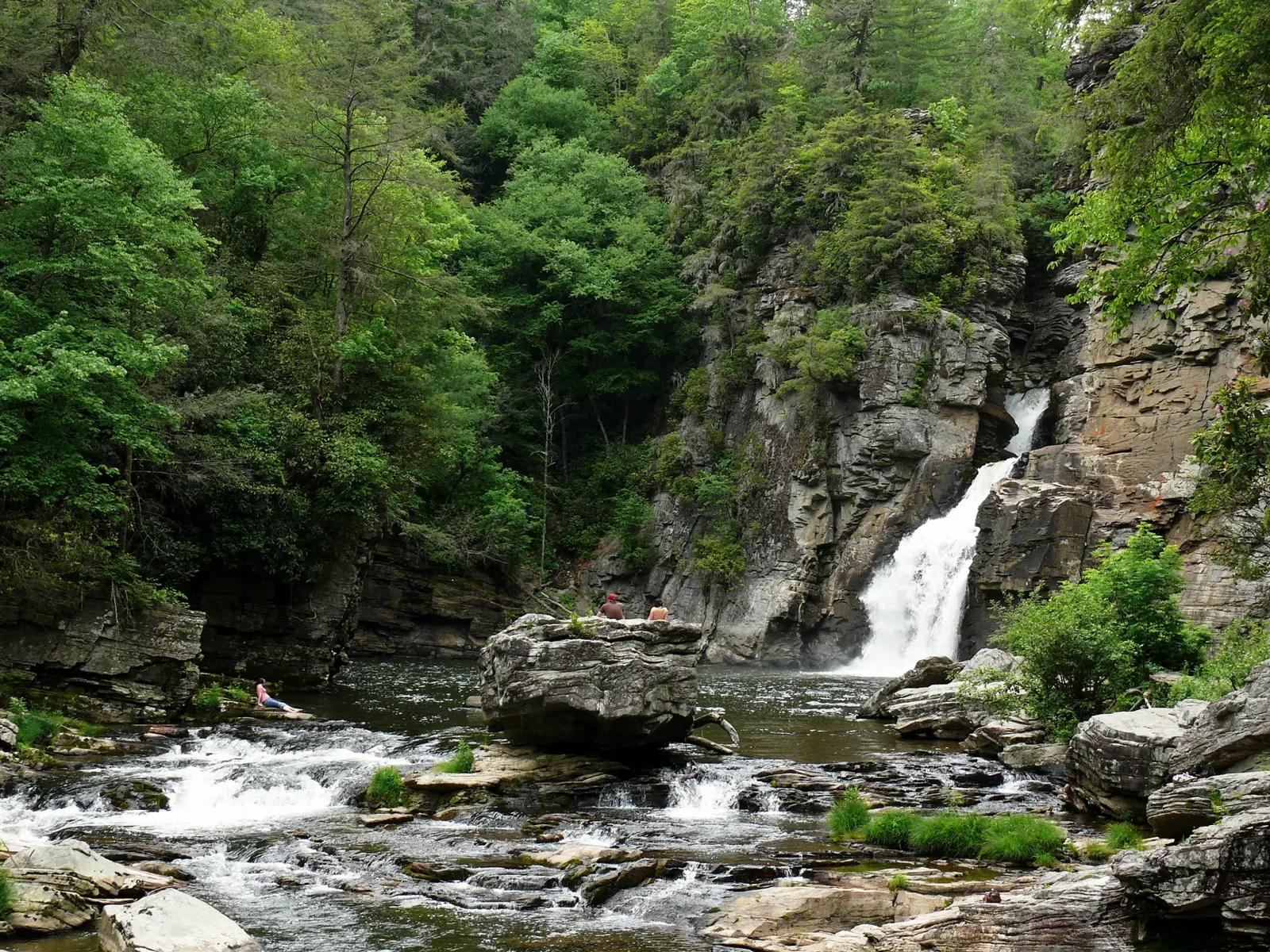
Linville Falls ranks among the most photographed waterfalls on the Blue Ridge Parkway, and one strong trail system shows you every angle of it. The falls sits at the head of Linville Gorge, a deep cut in the mountains that locals often call the Grand Canyon of the East.
The Linville River slides off the high slopes of Grandfather Mountain, spills over a pair of upper cascades, squeezes through a narrow rock chute and plunges 45 feet into the gorge. Trails from a single trailhead reach overlooks above the falls and the riverbank at the base.
This guide walks the Erwins View Trail overlook by overlook, covers the rougher gorge trails, and lays out the timing, safety and packing notes that make the stop run well. Drivers building a longer route can start with our Blue Ridge Parkway road trip guide.
Linville Falls at a Glance
| Topic | What hikers should know |
|---|---|
| Location | Milepost 316.4 on the Blue Ridge Parkway, near the town of Linville |
| Entry cost | Free; the parkway charges no entry fee and parking costs nothing |
| Main drop | The lower falls plunges 45 feet into Linville Gorge |
| Trails | Two main routes and one short side trail from the visitor center |
| Swimming | Banned in the Linville River; the current runs fast and the rocks stay slick |
| Facilities | Visitor center, campground and picnic area all run on seasonal schedules |
Quick Facts Before You Go
- The falls drops in two main tiers. The upper falls spreads wide and calm, and the lower falls makes the big 45 foot plunge into the gorge.
- The full drop from the top of the upper falls to the plunge pool totals about 90 feet.
- The upper falls stands about 12 feet tall, and the river twists through a narrow chute of rock between the two tiers.
- The Linville River begins a descent of nearly 2,000 feet through the gorge on its way toward Lake James.
- Cherokee people called this river Eeseeoh, a name that means river of many cliffs.
- Congress protected Linville Gorge in 1964 as the first officially designated wilderness area in the nation, and the trails cross remnants of a virgin hemlock forest.
- Hurricane Helene damaged parts of this area in September 2024, and some trails remain closed while crews repair them. Check the Park Service page for Linville Falls on the morning of your visit and confirm which trails stand open that day.
Getting There and Parking
Leave the parkway at milepost 316.4 and follow the short spur road down to the visitor center parking area. The community of Linville Falls and the junction with US 221 sit about a mile from the exit.
Drivers coming from Marion or Morganton can skip the parkway entirely. US 221 and NC 183 both reach the same junction, and signs point drivers up the spur road to the trailhead.
The visitor center hands out trail maps beside the restrooms and the picnic area, and a small shop sells books and supplies in season. The center opens seasonally, so confirm the current schedule on the Park Service site before you count on it.
Fall weekends fill the main lot by late morning. Arrive before 10 a.m. on an October Saturday, or come late in the afternoon after the tour groups leave.
The Erwins View Trail, Overlook by Overlook
The Erwins View Trail gives most visitors their Linville Falls hike. The moderate route runs 1.6 miles round trip, links four overlooks and starts with a footbridge over the calm river behind the visitor center.
Upper Falls Overlook at 0.5 Miles
The path drops slightly through hemlocks and reaches the first overlook at 0.5 miles. Here the river widens, pauses and spills gently over the twin upper cascades.
You stand almost on top of the falls at this stop. The water funnels into a twisted rock chute below the overlook and vanishes from sight, and the roar from the hidden lower falls drifts up through the trees.
Chimney View Overlook at 0.7 Miles
The trail climbs hard past Upper Falls, and the Park Service rates this stretch strenuous with real elevation gain. Slow down, use the steps and let faster hikers pass.
Chimney View rewards the climb at 0.7 miles. This overlook gives you the first full look at the lower falls, plus a view back up at the upper falls in the same frame. Tall rock outcrops beside the falls give the overlook its name, and most photographers rate this spot the best camera angle on the trail.
Gorge View Overlook
A short fork beyond Chimney View climbs to Gorge View, where the waterfall leaves the frame and the gorge takes over. The river bends away between Linville Mountain on one side and Jonas Ridge on the other.
Hawks and ravens ride the rising air below the rim on warm afternoons. This quiet overlook draws a fraction of the Chimney View crowd, so linger here if the main stops feel busy.
Erwins View Overlook at 0.8 Miles
The trail ends at Erwins View, 0.8 miles from the visitor center. Stone terraces open onto the widest panorama of the hike, with the upper and lower falls in the distance and the river threading the gorge below.
Take your group photo here, eat a snack and turn back the way you came. The return walk runs mostly downhill and brings the round trip to 1.6 miles.
Families handle this trail well with breaks at each overlook. Parents comparing waterfall stops for small legs can line this hike up against the other routes in our Blue Ridge Parkway with kids guide.
The Gorge Trails: Down to the River
The Linville Gorge Trail trades overlooks for the river itself. The strenuous route runs 1.4 miles round trip, and it forks 0.2 miles from the visitor center.
- The right fork follows the Plunge Basin Trail to Plunge Basin Overlook, a rock perch with a close side view of the lower falls and the Chimneys. This route totals 1 mile round trip.
- The left fork winds down through rock cliffs on steep steps, passes handrails above big drops and ends at the riverbank at the base of the falls, where the falling water digs out a large pool.
- Hikers who walk both forks log about 1.8 miles in total, and strong legs can pair the gorge trails with Erwins View in one long morning.
Treat the riverbank as a viewing spot and nothing more. Wet rock near the pool gives almost no grip, and the current runs strong even in dry weeks.
Every Trail at Linville Falls
| Trail | Distance | Difficulty | Best for |
|---|---|---|---|
| Erwins View Trail | 1.6 miles round trip | Moderate | First visits and all four overlooks |
| Linville Gorge Trail | 1.4 miles round trip | Strenuous | Standing at the base of the falls |
| Plunge Basin Trail | 1 mile round trip | Strenuous | A close look at the lower falls |
| Duggers Creek Trail | 0.4 mile loop | Easy | A small second waterfall beside the parking area |
Best Time to Visit
- Spring brings the strongest flow of the year, and wildflowers line both trails from April into May. Spring rain swells the river and turns the lower falls loud.
- Rhododendron thickets crowd the trails, and the blooms usually peak in June. Mountain laurel adds white and pink flowers along the gorge rim.
- Summer wraps the trails in deep shade, and the forest floor stays cool while valley towns bake. Afternoon storms build fast, so start hikes in the morning.
- Fall paints the gorge red and gold, and the Park Service photos of this spot almost always show autumn color. Color at this elevation usually peaks in mid October, and so do the crowds.
- Winter strips the leaves and opens long views through the gorge. Ice coats the gorge trails, and snow closes parkway sections near the falls for days at a time.
Flow follows the rain in every season. A wet week turns the plunge into a roar and can flood low spots on the gorge trail, while a dry month thins the upper cascades to a quiet slide. Check the river conditions and the trail status on the Park Service page on the day you go.
Our Blue Ridge Parkway in winter guide explains how winter closures work on this stretch of the road and which stops stay reachable in cold months.
Water and Weather Safety Rules
- Park rules ban swimming in the Linville River, and climbing on the rocks breaks the rules as well. The current and the slick stone make the plunge pool dangerous.
- Stay on the trail and behind the rails at every overlook. Cliff edges crumble, and wet rock offers no second chances.
- Never wade or cross the river above the falls. The current pushes far harder than it looks from the bank.
- Turn back if storms build while you hike the gorge trails. Heavy rain upstream can raise the river fast.
- Watch roots, wet leaves and mud on the climb to Chimney View, the steepest stretch on the main trail.
- Check the Park Service page on the morning of your hike for trail closures, and respect every closed gate while Helene repair work continues.
- Cell signal fades inside the gorge. Download your maps and this guide before you leave the parking area.
What to Pack
- Shoes with deep tread; the gorge trails mix mud, roots and bare rock
- A full water bottle per person, since the trails offer no water taps
- A rain layer, because gorge weather turns fast and storms roll off Grandfather Mountain
- A warm layer for spring and fall mornings at this elevation
- Snacks or a picnic for the tables near the visitor center
- A camera with a charged battery; Chimney View and Erwins View reward patience
- A leash of six feet or shorter for your dog, plus water and waste bags
- A small trash bag, so you pack out every wrapper and tissue
Staying Longer: Campground and Picnic Area
The Linville Falls Campground spreads 70 tent and RV sites through the woods a short walk from the trails. The campground opens seasonally, and fall weekends fill it fast, so reserve ahead where the Park Service allows reservations and check the current opening schedule before you plan a night.
The picnic area near the visitor center offers tables under the trees and an easy lunch stop between hikes. Pack food in, because the trailhead serves no meals and the nearest restaurants sit in the Linville Falls community and the town of Linville.
Nearby Stops Worth Adding
- Linville Caverns sits on US 221 a short drive south of the parkway junction. Guided tours of 30 to 40 minutes wind past stalactites, stalagmites and an underground stream, and the caverns hold a steady temperature near 52 degrees all year. Tours run year round on a seasonal schedule.
- Grandfather Mountain waits about 11 miles north at milepost 305. A private nonprofit runs the attraction and charges its own entry fee, and the ticket buys the Mile High Swinging Bridge, animal habitats and summit trails.
- The town of Linville stands where US 221 meets NC 105, a few minutes north of the falls. The town covers food, fuel and lodging, and it makes a handy base for two or three days of parkway stops.
- Duggers Creek Falls hides behind the main parking area on the short loop trail from the table above. A wooden bridge frames the small falls, and the walk takes about 20 minutes.
Travelers sleeping off the parkway can compare Linville with Blowing Rock, Banner Elk and the other bases in our guide to the best North Carolina mountain towns.
FAQs
The Erwins View Trail runs 1.6 miles round trip, and most hikers finish it in 1 to 2 hours with stops at all four overlooks. The Linville Gorge Trail adds 1.4 miles round trip, and hikers who walk both routes should plan on half a day.
The Park Service rates the Erwins View Trail moderate overall, and the climb to Chimney View turns strenuous with real elevation gain. Both gorge trails rate strenuous, with steep steps and rough rock near the river.
Chimney View gives the classic shot, with the lower falls and the upper falls in one frame. Erwins View gives the widest panorama of the falls, the river and the full gorge, so walk the extra stretch if your legs allow it.
No. Park rules ban swimming in the Linville River and climbing on the rocks. Strong current, deep water and slick stone make the plunge pool dangerous, and rangers enforce the ban.
Spring brings the strongest flow and wildflowers along the trails. Mid October brings peak fall color at this elevation and the biggest crowds of the year. Summer brings shade and storms, and winter brings open views with ice on the gorge trails.
No. The Blue Ridge Parkway charges no entry fee, and parking at the visitor center costs nothing. The campground charges a nightly fee in season, and nearby attractions such as Grandfather Mountain and Linville Caverns charge their own entry.
Yes. Parkway trails welcome dogs on a leash of six feet or shorter. Bring water for your dog, keep your dog on the trail and out of the river at the falls, and pack out all waste.
Plan 2 hours for the Erwins View Trail and the visitor center. Plan half a day if you add the gorge trails or a picnic, and a full day if you pair the falls with Linville Caverns or Grandfather Mountain.
Plan Your Linville Falls Stop
Pick Erwins View for your first visit, add the gorge trails if your legs and the trail status allow it, and check the Park Service page before you leave your hotel. One morning here explains why photographers rank this waterfall at the top of the parkway list.
Pair the hike with a picnic under the hemlocks or a night at the campground, and Linville Falls turns from a quick photo stop into the anchor of your whole parkway day.