




Last updated: October 1, 2026
The Blue Ridge Parkway hides some of the best waterfalls in the Southeast. Some sit right beside the road. Others need a short hike through rhododendron forest. A few reward you with a cold swimming hole at the end.
This guide covers the 10 best Blue Ridge Parkway waterfalls, listed north to south. You get the milepost, the hike distance, and what to expect at each one.
Use it to plan a waterfall day trip or to add a few stops to a longer parkway drive.
Blue Ridge Parkway Waterfalls at a Glance
- Most famous: Linville Falls (MP 316.4) with three trails to different viewpoints
- Best loop hike: Crabtree Falls, North Carolina (MP 339.5), 2.5 miles round trip
- Easiest to see: Glassmine Falls (MP 361.2) from a roadside overlook, no hiking needed
- Best swimming: Skinny Dip Falls (MP 417), a short hike to clear mountain pools
- Range: from easy roadside views to longer hikes, so every fitness level has an option
Waterfalls on the Blue Ridge Parkway: North-to-South Map
Here is the quick list. Mileposts run from 0 at the north end in Virginia to 469 at the south end in North Carolina. Details for each fall follow below.
| Waterfall | Milepost | Hike | Difficulty |
|---|---|---|---|
| Fallingwater Cascades | 83.1 | 1.2 to 1.6 miles | Easy to moderate |
| Cascade Falls (E.B. Jeffress Park) | 271.9 | About 1 mile | Easy, but stairs; not wheelchair accessible |
| Linville Falls | 316.4 | 1 to 1.6 miles | Easy to strenuous |
| Crabtree Falls (NC) | 339.5 | 1.8 to 2.5 miles | Moderate to strenuous |
| Glassmine Falls | 361.2 | None, roadside overlook | None |
| Douglas Falls | 364.6 or Forest Rd 74 | 1 mile or about 8 miles | Easy or strenuous |
| Skinny Dip Falls | 417 | 0.8 miles | Easy |
| Graveyard Fields Lower Falls | 418.8 | Under 1 mile | Easy |
| Graveyard Fields Upper Falls | 418.8 | 1.6 miles | Easy to moderate |
| Looking Glass Falls | Detour off US-276 | None, roadside | None |
Planning Your Route: A Blue Ridge Parkway Waterfalls Map in One Day
Many visitors search for waterfalls on Blue Ridge Parkway hoping to see them all in one day. That is not possible.
The parkway runs 469 miles, and the falls spread across Virginia and North Carolina. Pick one cluster instead and enjoy it at a slow pace.
North cluster (Virginia): Fallingwater Cascades at milepost 83.1 pairs with a stop at Peaks of Otter. This works as a half-day trip from Roanoke.
Middle cluster (High Country): Cascade Falls (271.9), Linville Falls (316.4), and Crabtree Falls (339.5) fit into one long day from Boone or Blowing Rock.
Start at Linville Falls in the morning, eat lunch near Crabtree Falls (reachable again since the October 2026 reopening; only its campground stays closed for 2026), and finish at Cascade Falls.
South cluster (Asheville): Glassmine Falls (361.2), Douglas Falls, Skinny Dip Falls (417), and both Graveyard Fields falls (418.8) make a full waterfall day from Asheville. Add the Looking Glass Falls detour on US-276 if you have time.
Save this page as your Blue Ridge Parkway waterfalls map. The mileposts in the table above run in order from north to south, so you can follow them like a checklist as you drive.
Linville Falls Hike (MP 316.4): Trails and Best Viewpoints
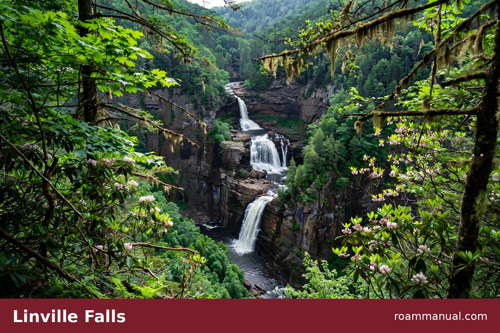
Linville Falls is the most famous waterfall on the Blue Ridge Parkway. It drops in three tiers into Linville Gorge, which locals call the Grand Canyon of the Southern Appalachians.
Three separate trails lead to different viewpoints, so you can pick the walk that fits your legs.
The three trails:
- Falls Trail: the easiest option at 1.6 miles round trip. It leads to overlooks of the upper falls
- Plunge Basin Trail: 1 mile round trip, to a viewpoint above the main drop
- Gorge Trail: 1.4 miles round trip and strenuous, with a steep climb back out
Key viewpoints:
- Upper Falls
- Chimney View
- Erwins View
Each one shows a different tier of the falls. If you only have time for one stop, walk the Falls Trail to Chimney View. You see the most water from the least effort.
Linville Falls flows strongest in spring and after heavy rain. In dry summers it shrinks to a thinner ribbon. Go early in the morning on fall weekends, because the parking area fills fast in October.
Crabtree Falls Loop Trail (NC, MP 339.5)
Crabtree Falls is the best waterfall hike on the parkway. The trail starts at the Crabtree Falls Campground at milepost 339.5 and loops 2.5 miles through hardwood forest to a 60-foot cascade.
If the full loop sounds like too much, a 1.8-mile round trip on the same trail reaches the falls with less climbing.
Do not confuse this waterfall with its Virginia namesake. A different Crabtree Falls sits near Montebello, Virginia, off the parkway. This guide covers the North Carolina Crabtree Falls at milepost 339.5.

The trail descends most of the way to the falls, which means you climb on the way back.
Take your time and bring water. The waterfall runs best after rain, so spring and wet summers give you the fullest flow.
Note for 2026: the Crabtree Falls Campground is closed for all of 2026 because of Helene damage. The parkway past the trailhead reopened in October 2026, though, so the falls are reachable by road again. Check the NPS conditions page before planning this stop. In a normal season, it pairs well with Linville Falls for a strong waterfall day, since the two sit about 23 miles apart.
Easiest Waterfalls on the Blue Ridge Parkway
Not every waterfall needs a long hike. These three take almost no effort and still deliver a real waterfall payoff.
Glassmine Falls (MP 361.2)
Glassmine Falls is the only waterfall on this list with no trail at all. Pull into the overlook at milepost 361.2, walk a short paved path, and look across the valley.
After heavy rain the skinny falls drops dramatically down the rock face. In dry weather it shrinks to a trickle, so time your visit after a storm.
The sign at the overlook claims 800 feet, but you see about 200 feet of it through the trees. You cannot hike to the base.
The falls sit inside Asheville’s watershed, so close access is prohibited. Bring binoculars if you want a better look.
Cascade Falls at E.B. Jeffress Park (MP 271.9)
This is one of the easiest waterfall hikes on the parkway. At E.B. Jeffress Park, an easy one-mile walk follows a gently graded path to a tall, multi-tier cascade. Stairs near the falls mean the path is not wheelchair accessible. A short loop circles the falls for different angles.
The park also has picnic areas and restrooms, which makes it a good family stop. It sits just south of Boone, so it pairs well with a visit to the High Country.
Skinny Dip Falls (MP 417)
Skinny Dip Falls is the parkway’s best swimming hole.
Park at the Looking Glass Rock Overlook at milepost 417, cross the road to the Mountains-to-Sea Trail, and walk 0.8 miles round trip through the forest to clear pools and small cascades.
Know this before you go: Tropical Storm Fred damaged the area in 2021 and destroyed the old footbridge.
The trail was rerouted, and the falls look different than they did before the storm. The hike is still short and pleasant, and the pools are still swimmable, but set your expectations for a changed landscape.
More Waterfalls Worth the Stop (North to South)
Fallingwater Cascades (MP 83.1)
Virginia drivers get their waterfall early. At the Peaks of Otter area, the Fallingwater Cascades Trail leaves from the parking area at milepost 83.1.
Hike the 1.6-mile loop for a moderate walk, or take the 1.2-mile out-and-back for an easier version.
The cascades drop about 100 feet over a series of rocky ledges. Spring gives the best flow, and the rhododendron blooms in late May and early June make the trail extra pretty.
Douglas Falls (MP 364.6 or Forest Road 74)
Douglas Falls is a 70-foot waterfall with two very different routes.
The hard way starts at the Craggy Gardens Visitor Center at milepost 364.6 and runs about 8 miles round trip on a rugged, strenuous trail. This route suits experienced hikers only.
The easy way drives Forest Road 74, an unpaved road also called Big Ivy, then hikes 1 mile round trip on a mostly level trail. The gravel drive itself passes small roadside cascades, including Walker Falls.
Note that recent hikers report storm damage on trails in this area after Hurricane Helene, so check current conditions before you go.
Graveyard Fields Lower Falls (MP 418.8)
Graveyard Fields is one of the most popular stops on the southern parkway, and the Lower Falls is why many people come. The walk from the parking area runs under a mile on a clear trail.
The falls spread wide over multiple rock tiers into a broad pool that draws waders on hot summer days.
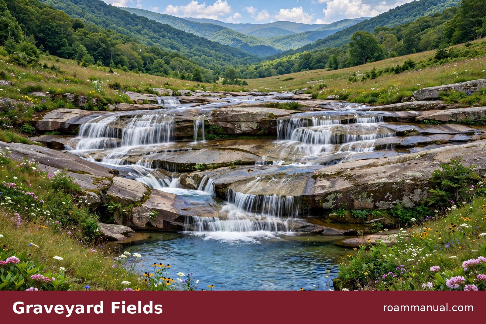
The area also has restrooms, which is rare for a parkway trailhead. The high valley sits above 5,000 feet, so wildflowers fill the meadows in summer and blueberries ripen in August.
Graveyard Fields Upper Falls (MP 418.8)
Keep walking past the Lower Falls and the crowds thin out. The Upper Falls sits about 1.6 miles from the trailhead via a spur trail. (Second Falls is another name for the Lower Falls downstream.)
It is narrower and taller than the Lower Falls, framed by boulders and thick forest.
The full Graveyard Fields loop runs about 3.2 miles with about 400 feet of elevation gain. Most hikers rate it easy to moderate. Walk the whole loop to see both falls, the open meadows, and the boardwalks over Yellowstone Prong.
Looking Glass Falls (Detour off US-276)
Looking Glass Falls is not technically on the parkway, but it belongs on this list as a nearby detour. Leave the parkway near milepost 412 and follow US-276 toward Brevard.
The falls drop right beside the road, so you see them from your car window. A short staircase leads to the base for photos.
This is the easiest waterfall in the region to photograph. No hiking, no parking fee, no effort. Pair it with a drive on US-276, which also passes the Cradle of Forestry and the road to Looking Glass Rock.
Check Trail and Road Status Before You Go
Hurricane Helene hit western North Carolina hard in 2024, and some parkway sections and trails took damage. Repairs continue, and conditions change by season. A trail that was open last month can close after a storm.
Before you drive, check the official NPS road conditions page at nps.gov/blri/planyourvisit/conditions.htm. It lists current closures for the parkway itself.
For trail-specific damage, check recent hiker reports on the park’s official pages. This matters most for Douglas Falls and the trails near Mount Mitchell, where Helene damage reports are most common.
Waterfall Safety Tips
- Never climb a waterfall. Wet rock is slick, and most parkway waterfall injuries happen on climbs.
- Stay behind railings and on marked trails. The drop at the top of a falls is unforgiving.
- Watch for flash floods. If rain starts upstream, water levels can rise fast. Leave the gorge if the sky turns dark.
- Expect cold water. Mountain pools stay cold even in July. Ease in slowly and never dive into water you cannot see through.
- There are no lifeguards. Swim at your own risk and keep kids within arm’s reach.
- Wear shoes with grip. The rocks around every falls on this list get slippery.
Best Time to Visit the Waterfalls
Spring brings the strongest flow. Snowmelt and spring rain fill every creek, and the falls run at their fullest from March through May. The forest also blooms with rhododendron and mountain laurel in late spring.
Summer is swimming season. The water stays cold, but on a hot July day the pools at Skinny Dip Falls and Graveyard Fields Lower Falls feel perfect. Go on weekday mornings to beat the crowds.
Fall pairs waterfalls with color. October brings peak foliage to the high elevations, and a waterfall framed by red and orange leaves makes a great photo.
Read our Blue Ridge Parkway fall colors guide to time your trip for peak color.
Winter can be beautiful but tricky. The falls sometimes freeze into ice formations, but the parkway often closes in winter weather. Check the NPS conditions page before you attempt a winter visit.
Where to Stay for a Waterfall Trip
For the northern falls, base yourself in Boone or Blowing Rock. Both towns sit close to Cascade Falls and within an hour of Linville Falls. For the southern falls, Asheville works best.
Glassmine Falls, Douglas Falls, Skinny Dip Falls, and Graveyard Fields all sit within an hour of downtown. Read our where to stay in Asheville guide for neighborhood picks.
Little Switzerland is a quiet middle option near Linville Falls and Crabtree Falls. It has a few inns and a famous bookshop, and it keeps you on the parkway itself.
Blue Ridge Parkway Waterfalls: FAQs
What is the most famous waterfall on the Blue Ridge Parkway?
Linville Falls. It is the most famous and most visited waterfall on the parkway, with three trails to different viewpoints at milepost 316.4.
Can you swim in the waterfalls on the Blue Ridge Parkway?
Yes, at some of them. Skinny Dip Falls is the best swimming hole, with clear pools at the end of a short hike. People also wade in the pool below Graveyard Fields Lower Falls.
There are no lifeguards anywhere, the water stays cold year round, and you should never dive into water you cannot see through.
Which waterfall on the Blue Ridge Parkway is the easiest to see?
Glassmine Falls. You see it from a roadside overlook at milepost 361.2 with no hiking at all. Cascade Falls at E.B. Jeffress Park is the easiest true hike, with a one-mile path that has stairs near the falls.
Which waterfall is closest to Asheville?
Glassmine Falls sits about 30 miles north of Asheville at milepost 361.2. Douglas Falls is also close but needs a hike or a gravel-road drive. Looking Glass Falls is a short detour south of the parkway near Brevard.
Are the waterfalls on the Blue Ridge Parkway free?
Yes. The parkway charges no admission fee, and none of the waterfalls on this list charge for parking or access.
Are dogs allowed on the waterfall trails?
Dogs on leash are allowed on most Blue Ridge Parkway trails, including the waterfall hikes in this guide. Bring water for them and keep them off fragile vegetation near the falls.
When is the best time to see the waterfalls?
Spring gives the strongest flow. After any heavy rain the falls run fuller in every season. Fall adds colorful leaves around the water, which makes October a great month for waterfall photography.
Can I see waterfalls on Blue Ridge Parkway in one day?
Yes, if you stick to one cluster. The Asheville cluster packs five waterfalls into about 60 miles of parkway. The High Country cluster fits three falls into one long day from Boone.
Do not try to drive the full 469 miles for waterfalls in a single day.
Is Crabtree Falls in North Carolina or Virginia?
Both states have one. This guide covers the North Carolina Crabtree Falls at milepost 339.5 on the Blue Ridge Parkway. Virginia has a separate Crabtree Falls near Montebello that is not on the parkway.
The best Blue Ridge Parkway waterfalls give the parkway a different kind of beauty than the overlooks.
Plan your stops around the mileposts above, check trail conditions before you drive, and add these falls to your Blue Ridge Parkway road trip itinerary. For more trip ideas, browse our things to do in Asheville guide.
