



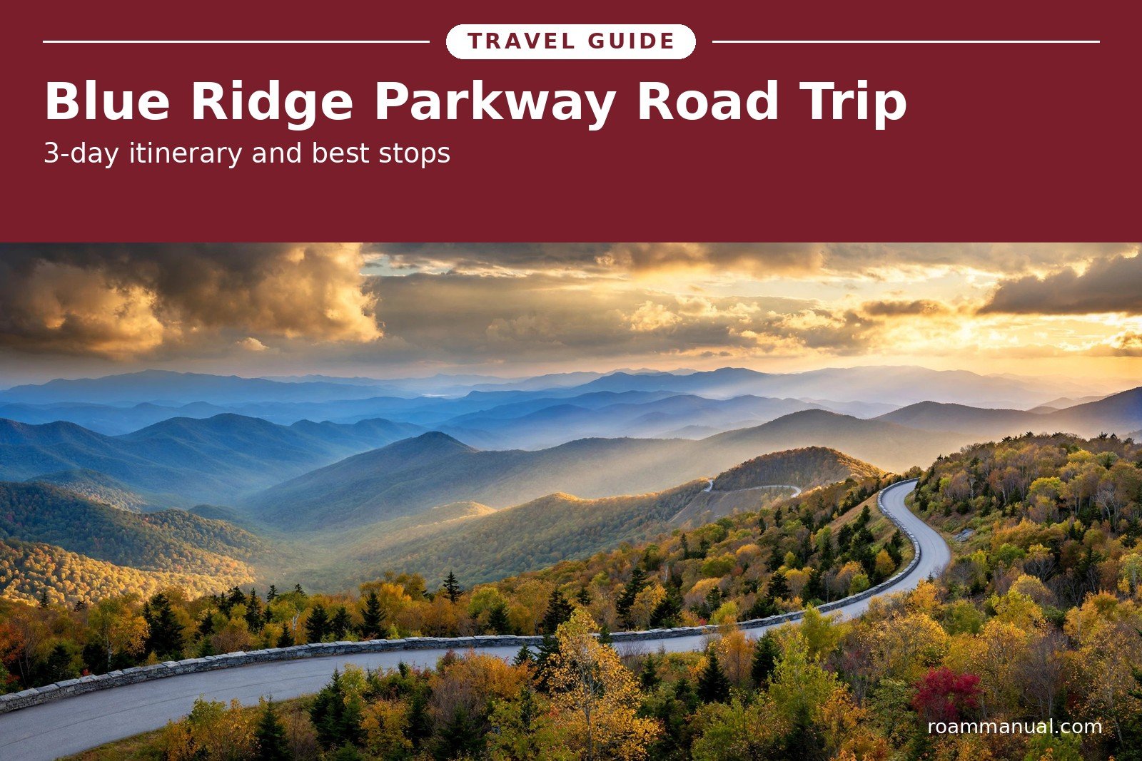
A Blue Ridge Parkway road trip is 469 miles of mountain views with no stoplights, no billboards, and no entrance fee.
The road runs from Rockfish Gap in Virginia to Cherokee in North Carolina, connecting Shenandoah National Park to Great Smoky Mountains National Park.
This guide gives you everything you need to plan it:
- How long the drive takes
- Which direction to drive
- A complete 3-day itinerary
- The best stops
- Waterfalls
- Short hikes
- Overlooks
- Where to stay
- The best time to go
You do not need to be an experienced road tripper. The speed limit never tops 45 mph, the route is well marked, and every few miles another overlook invites you to pull over.
- Pack snacks
- Download offline maps
- Give yourself more time than you think you need
The road forces you to slow down, and that slower pace is exactly why drivers love it.
Blue Ridge Parkway Road Trip at a Glance
Takeaway: A Blue Ridge Parkway road trip covers 469 miles, from Rockfish Gap, Virginia (MP 0) to Cherokee, North Carolina (MP 469).
- Speed limit: 45 mph
- No gas stations on the parkway itself
- Entry is free
- Plan at least 3 days
How Long Does It Take to Drive the Blue Ridge Parkway?
It takes 10 to 12 hours to drive the Blue Ridge Parkway nonstop. Plan 3 days and 2 nights to actually enjoy it.
The speed limit never goes above 45 mph, and with stops your real pace will be far slower. Overlooks, short trails, and visitor centers add hours to the drive, and that is the whole point of the road.
Rushing it in one long day means skipping the best parts. The parkway rewards slow travel, so treat the drive itself as the destination.
On a real Blue Ridge Parkway road trip, plan for 150 to 200 miles per day.
That pace leaves room for all of this without ever feeling rushed:
- A morning hike
- A long lunch stop
- A sunset overlook
Takeaway: My recommendation is 3 days and 2 nights.
- Day 1: the Virginia section
- Day 2: the High Country around Blowing Rock
- Day 3: the Asheville to Cherokee stretch
Which Direction Is Best: North to South or South to North?
Drive north to south. That is the better direction for a first Blue Ridge Parkway road trip.
Starting at Rockfish Gap lets you connect straight off Skyline Drive in Shenandoah National Park. The scenery builds as you go, and the highest, most dramatic peaks wait for the final stretch in North Carolina.
You finish at the edge of Great Smoky Mountains National Park, which feels like a natural ending point.
South to north works better in two cases:
- You are already in Asheville or the Smokies, so starting at Cherokee saves backtracking
- You drive in late fall, when color peaks first at the higher southern elevations
Either way, the road is the same beautiful drive. Pick the direction that fits your starting city and your lodging bookings, then stop worrying about it.
The Best 3-Day Blue Ridge Parkway Itinerary
This 3-day Blue Ridge Parkway itinerary covers the full 469 miles without rushing, and it is built for a real Blue Ridge Parkway road trip pace.
Each day pairs relaxed drive time with the best stops, and each night ends in a town with food and lodging.
Start early each morning. Overlooks are emptiest before 10 a.m., and afternoon light is best for the west-facing views on Day 2 and Day 3.
The tables below show every key stop with its milepost and a suggested time, so you can trim or extend each day to fit your style.
Day 1: Rockfish Gap to Roanoke (MP 0 to about 120)
| Stop | Milepost | Time needed |
|---|---|---|
| Rockfish Gap (start) | MP 0 | 15 minutes |
| Humpback Rocks | MP 6 | 1 hour |
| James River Visitor Center | MP 63.6 | 30 minutes |
| Peaks of Otter | MP 86 | 1 to 2 hours |
| Roanoke (overnight) | MP 120 | Evening |
Day 1 is a gentle introduction. Humpback Rocks is a short, steep climb to a rocky outcrop with wide valley views, and it sets the tone for the whole trip.
The James River Visitor Center sits at the lowest point of the parkway, where the road crosses the river on an arched bridge. Give yourself a full hour at Humpback Rocks, since the climb is steeper than it looks.
Peaks of Otter is the highlight of the day:
- Walk the flat loop around Abbott Lake
- Visit the lodge
- Hike up Sharp Top if your legs are fresh
Then roll into Roanoke for dinner and a real bed. The city sits just off the parkway and has the best food options of the three overnight stops.
Roanoke makes an easy first overnight stop because it sits minutes off the parkway.
Its downtown offers:
- Breweries
- Southern comfort food
- Live music
That mix makes a fun contrast after a quiet day on the road. Turn in early, because Day 2 is the biggest driving day of the trip.
Day 2: Roanoke to Blowing Rock area (MP about 120 to 305)
| Stop | Milepost | Time needed |
|---|---|---|
| Roanoke (start) | MP 120 | Morning |
| Rocky Knob | MP 169 | 30 minutes |
| Mabry Mill | MP 176 | 1 hour |
| Moses H. Cone Memorial Park | MP 294 | 1 hour |
| Julian Price Park and Price Lake | MP 297 | 45 minutes |
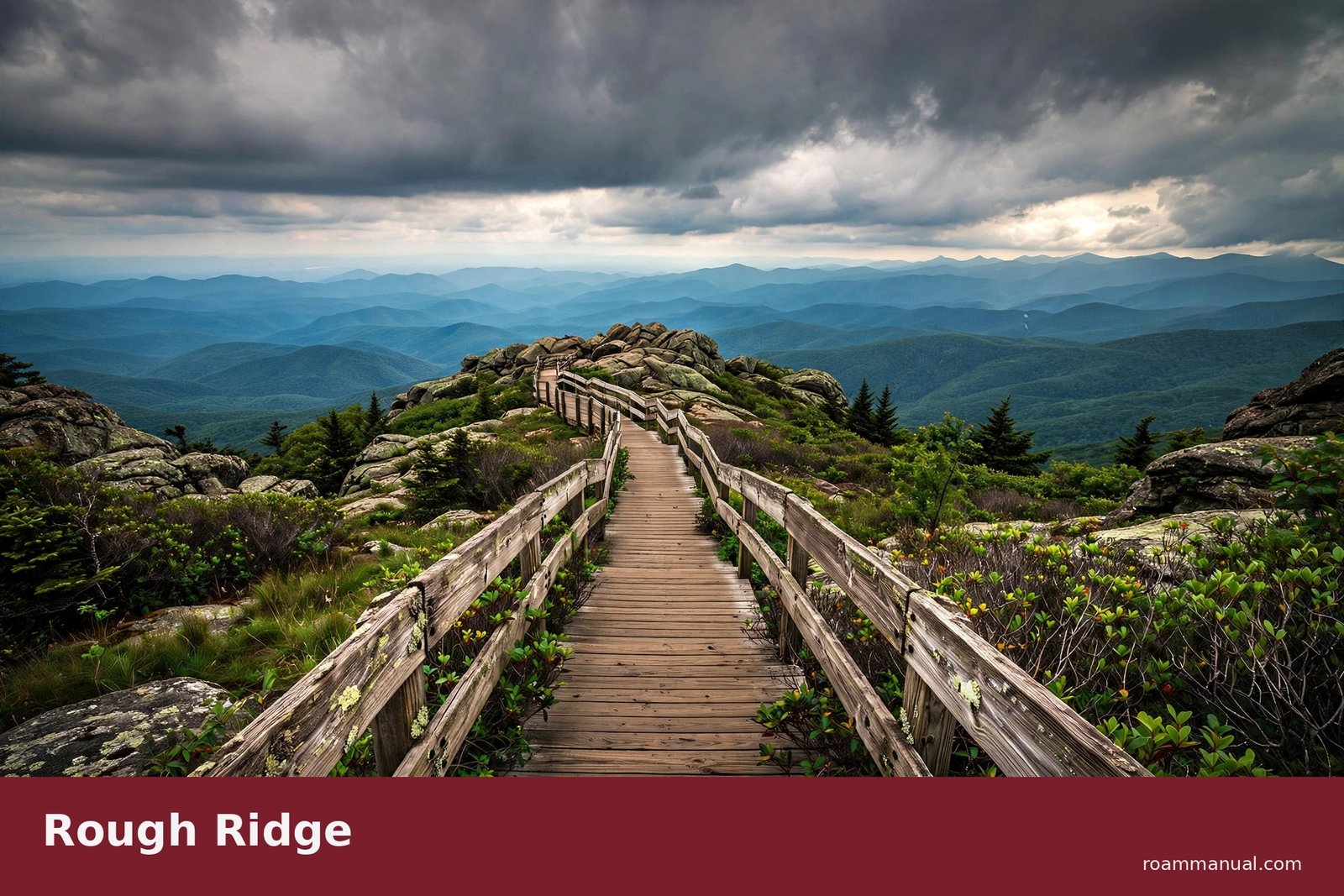
| Rough Ridge | MP 302.8 | 1 hour |
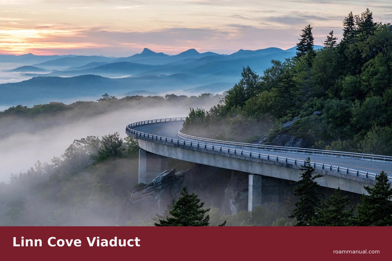
| Linn Cove Viaduct | MP 304 | 30 minutes |
| Blowing Rock or Boone (overnight) | MP 305 area | Evening |
Day 2 is the longest driving day, but it holds the most famous sights. Mabry Mill is the most photographed spot on the parkway, with a working gristmill and craft demonstrations on summer and early-fall weekends.
Arrive before lunch to beat the tour buses.
The afternoon belongs to the High Country. Moses H. Cone Memorial Park has a grand manor house and easy carriage trails, while Price Lake is perfect for a picnic or a paddle in season.
Then comes the one-two punch of Rough Ridge and the Linn Cove Viaduct.
Walk the Rough Ridge boardwalk for 360-degree views, then drive the viaduct itself, an engineering marvel that curves around Grandfather Mountain. Time it for late afternoon light if you can, when the bridge and the cliffs glow gold.
Sleep in Blowing Rock or nearby Boone, both full of restaurants and cozy inns. Blowing Rock is quieter and closer to the parkway, while Boone has more nightlife and budget options.
Either way, eat dinner before dark, because Day 3 starts early.
Day 3: Blowing Rock to Cherokee (MP about 305 to 469)
| Stop | Milepost | Time needed |
|---|---|---|
| Grandfather Mountain (detour) | MP 305 | 2 hours |
| Linville Falls | MP 316 | 1 to 2 hours |
| Crabtree Falls, NC | MP 339.5 | 2 hours |
| Mount Mitchell (detour via NC 128) | MP 355 | 1 to 2 hours |
| Craggy Gardens | MP 364 | 1 hour |
| Asheville (detour) | MP 384 | Half day |
| Oconaluftee and Cherokee (end) | MP 469 | 30 minutes |
Day 3 is waterfall and high-peak day. Linville Falls is the most powerful waterfall on the parkway, with several viewpoints of different difficulty.
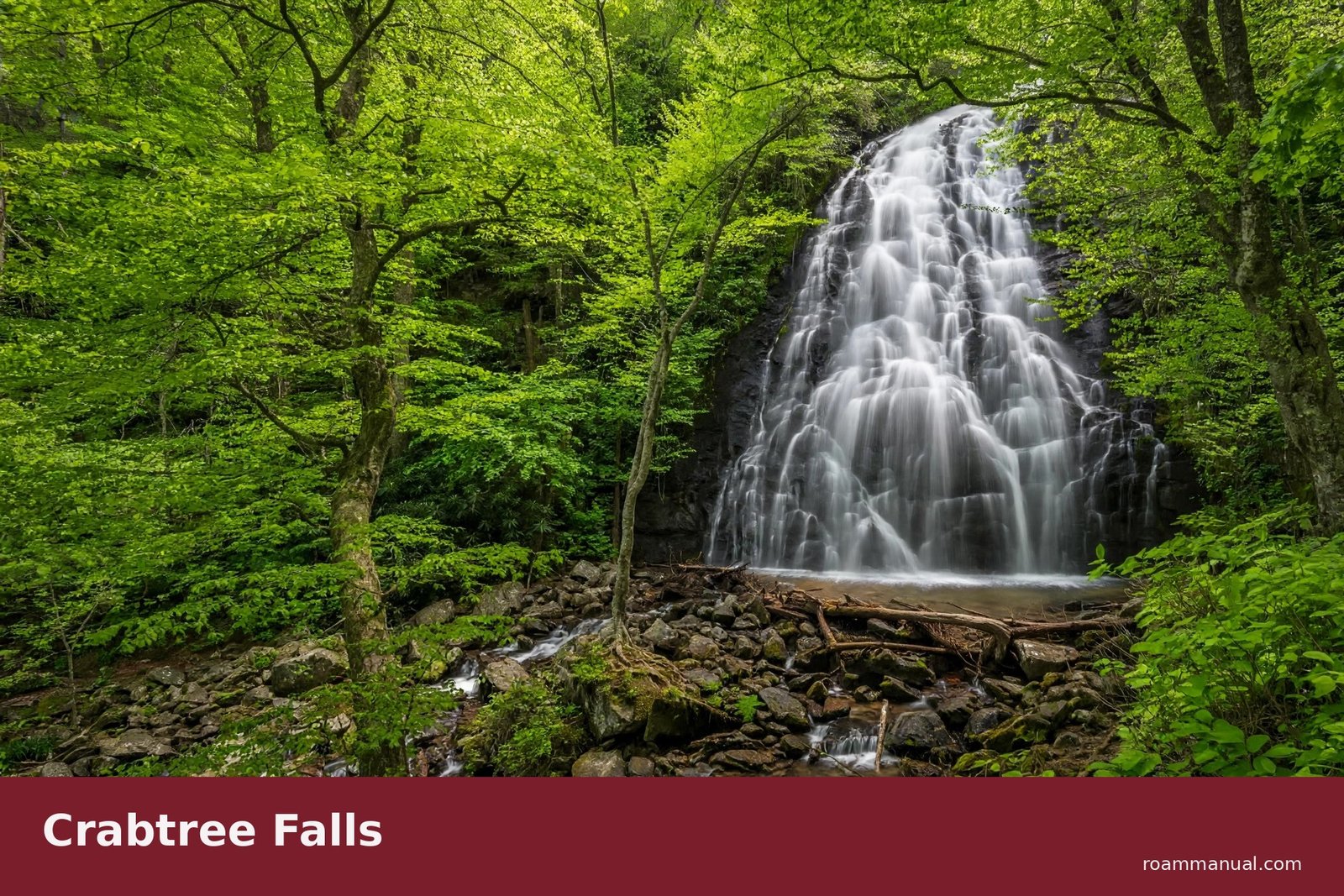
Crabtree Falls in North Carolina takes a little more effort, a wooded hike to a tall, graceful cascade, and it is worth every step.
October 2026 update: almost all of the parkway has reopened after Helene, 458 of its 469 miles, including the stretch past Linville Falls and Crabtree Falls. The only Helene closure left is MP 344.2 to 355.3, between NC-80 and Mount Mitchell. Detour around that gap on NC-80 and US-221, and reach Mount Mitchell from the Asheville side. Check the NPS road status page before you go.
Mount Mitchell is a short detour and the highest peak east of the Mississippi River. The observation deck gives you a view across endless blue ridges.
Craggy Gardens follows with its rhododendron tunnels and rocky balds, glowing in June bloom or October color.
This is the day to linger. The stretch from Linville Falls to Craggy Gardens packs more highlights per mile than anywhere else on the road, so do not rush it.
If a stop grabs you, stay an extra hour and steal the time from the Asheville detour instead.
If time allows, detour into Asheville for food and the Biltmore Estate. Then finish at Oconaluftee near Cherokee, where elk often graze in the meadows at dawn and dusk.
Note that Great Smoky Mountains National Park is a separate park, not part of the parkway. If you are torn between the two ranges, read Smoky Mountains vs Blue Ridge Mountains before you decide where to spend extra days.
15 Best Stops on the Blue Ridge Parkway
These are the best stops on the Blue Ridge Parkway, listed north to south. They mix famous landmarks with quieter spots that many drivers rush past.
If you are short on time, prioritize Mabry Mill, Rough Ridge, Linn Cove Viaduct, Linville Falls, and Craggy Gardens.
- Humpback Rocks (MP 6). A short, steep trail to a rocky summit with big valley views.
- Peaks of Otter (MP 86). Abbott Lake, a historic lodge, and three peaks to choose from.
- Mabry Mill (MP 176). The most photographed site on the parkway, with a working gristmill.
- Doughton Park (MP 238.5). Rolling meadows, old cabins, and some of the best picnic spots.
- Moses H. Cone Memorial Park (MP 294). A grand manor house with 25 miles of gentle carriage trails.
- Julian Price Park and Price Lake (MP 297). A calm mountain lake with an easy lakeside loop.
- Rough Ridge (MP 302.8). A boardwalk trail to 360-degree views, unbeatable at sunset.
- Linn Cove Viaduct (MP 304). The famous curving bridge around Grandfather Mountain.
- Grandfather Mountain (MP 305, detour). A private nature park with a mile-high swinging bridge and an entry fee.
- Linville Falls (MP 316). The most powerful waterfall on the parkway, with multiple viewpoints.
- Crabtree Falls, North Carolina (MP 339.5). A tall, elegant cascade at the end of a pretty forest hike.
- Mount Mitchell (MP 355, detour via NC 128). The highest peak east of the Mississippi, with a summit observation deck.
- Craggy Gardens (MP 364). Rhododendron tunnels and rocky balds with endless views.
- Folk Art Center (MP 382). Appalachian crafts, live demonstrations, and a great gift shop.
- Waterrock Knob (MP 451.2). Near the southern end, with huge sunset views in every direction.
You cannot see all 15 in one trip without rushing. Pick five or six, give each one real time, and save the rest for your next drive.
On a 3-day Blue Ridge Parkway road trip, most drivers find that three to four stops per day is the comfortable limit.
Best Waterfalls on the Blue Ridge Parkway
The Blue Ridge Parkway waterfalls are some of the best in the East. These five are all easy to reach from the road, and each one is different.
Most need only a short walk from the parking area, and two are visible almost from the car.
Crabtree Falls in North Carolina (MP 339.5) is a tall, graceful cascade dropping through a green forest cove.
The 2.5-mile loop trail leads to the base, and the trail is moderate but steady. Go in spring when the water is high. Good news for fall 2026: the parkway past the falls reopened in October, so Crabtree Falls is reachable by road again (see the Day 3 note).
Linville Falls (MP 316.4) is the most powerful waterfall on the parkway. The Erwins View trail, about 1.6 miles round trip, takes you to several overlooks of the upper and lower falls.
It is the best choice if you only have time for one waterfall.
Glassmine Falls (MP 361.2) is a roadside stop, no hiking required. The falls are seasonal and thin in late summer, so this one is best after rain./p>
Looking Glass Falls is a short detour off the parkway near MP 412 onto US-276. It is one of the most photographed waterfalls in North Carolina, and you can see it right from the road.
Skinny Dip Falls hides along the Mountains-to-Sea Trail near MP 417. It is a series of small cascades and swimming holes, perfect on a hot summer afternoon.
Waterfall flow changes with the seasons. Spring and early summer bring the strongest flows, while late summer can leave the smaller falls thin. After heavy rain, every cascade on this list puts on a show.
Want the full list with trail maps and parking tips? Read our Blue Ridge Parkway waterfalls guide.
Best Short Hikes on the Parkway
The Blue Ridge Parkway hiking trails include dozens of short walks with huge payoffs. These three give you the most view for the least effort.
Rough Ridge (MP 302.8). About 1.2 miles round trip, with boardwalk sections and cables near the top. The summit gives you 360-degree views of Grandfather Mountain and the Piedmont. Go at sunset if you can. Rough Ridge trail guide
Beacon Heights (MP 305.2). About 0.6 miles round trip, with two rock viewpoints facing different directions. It is the easiest big-view hike on the parkway and perfect for families. Beacon Heights trail guide
Craggy Gardens (MP 364). The Craggy Pinnacle trail is 1.4 miles round trip through rhododendron tunnels to a rocky summit. In June the blooms are unreal, and in October the color is just as good. Craggy Gardens trail guide
All three trails are well marked and busy on weekends. Start before 10 a.m. for easy parking, and carry more water than you think you need. Mountain sun and elevation make even short climbs feel harder than expected.
Best Overlooks for Sunrise and Sunset
The Blue Ridge Parkway best overlooks face east or west, so pick your stop by the time of day. East-facing pullouts glow at sunrise, west-facing ones burn at sunset.
Linn Cove Viaduct viewpoint (MP 304). Sunrise. Watch first light hit the famous bridge from the viewing area below it.
Craggy Pinnacle (MP 364). Sunset. A short walk from the parking area to west-facing rock outcrops.
Rough Ridge (MP 302.8). Sunset. The summit looks west over layers of ridges that turn purple and gold.
Waterrock Knob (MP 451.2). Sunset. Near the southern end, with a 360-degree panorama from the parking area and a short summit trail.
Cowee Mountains Overlook (MP 430.7). Sunset. A quieter pullout with long views down the valley, often empty at golden hour.
Timing tips for the best light:
- For sunrise, arrive 20 minutes before the sun comes up
- For sunset, stay 15 minutes after it goes down
The best color often comes after the sun dips below the horizon. Bring a light jacket even in summer, since high overlooks can feel much cooler than the valleys below.
Where to Stay on the Blue Ridge Parkway
Wondering where to stay on the Blue Ridge Parkway? There is almost no lodging directly on the road, so plan your nights in nearby towns.
Only two lodges sit on the parkway itself: Peaks of Otter Lodge in Virginia and Pisgah Inn in North Carolina, and both book out early for fall weekends.
Staying in town also means better dinners and a hot shower after a long day outside.
Night 1: Roanoke area.
- Budget: chain motels along the highways into town
- Mid-range: the inns and boutique hotels downtown
- Splurge: the historic Hotel Roanoke, the classic choice
Downtown has the best restaurant scene of the three overnight stops.
Night 2: Blowing Rock or Boone. Blowing Rock is a charming small town right by the parkway, with cozy inns and bed-and-breakfasts.
Boone, home to Appalachian State University, has more budget motels and a livelier evening scene. Both work well, so pick based on price and vibe.
Night 2 is the one to book first. Blowing Rock and Boone sit beside the highest, most popular section of the road, and their lodging sells out on busy fall weekends, so book this night first.
If you find a good rate here, lock it in and plan the other nights around it.
Night 3: Asheville. End in the mountains’ coolest city, with great food, breweries, and music.
If you are deciding on neighborhoods, check the best areas to stay in Asheville for first-timers before you book. Downtown and Biltmore Village are the most convenient bases.
Book fall weekends months ahead. October lodging near the parkway sells out fast and prices jump.
Best Time to Drive the Blue Ridge Parkway
The best time to drive the Blue Ridge Parkway depends on what you want to see. Every season has something, but fall wins for most people.
Here is what each season gives you, so you can pick the right month for your trip.
Fall (October). Peak color hits mid to late October, starting at the highest elevations and moving down. This is the most popular time on the road, so expect crowds on October weekends.
A fall Blue Ridge Parkway road trip is unforgettable, but it demands advance planning, so book lodging months ahead and aim for weekdays if you can. For week-by-week color timing, read Blue Ridge Parkway fall foliage guide.
Spring (May to June). Wildflowers and blooming rhododendron line the road, especially around Craggy Gardens in June. Crowds are thinner and the air is fresh.
Summer. The parkway is a cool escape from lowland heat, with highs often 10 to 15 degrees lower than nearby cities. Afternoon thunderstorms are common, so start hikes early.
Winter. Sections of the parkway close with ice and snow, and the road is not plowed in most areas. Always check NPS road closures page before a winter trip. The open sections are beautifully quiet.
Things to Do on the Blue Ridge Parkway
Beyond the views, there are plenty of things to do on the Blue Ridge Parkway. Stop at the visitor centers in Asheville, Linville Falls, and James River for maps and ranger advice.
More things to do along the way:
- Watch live craft demonstrations at Mabry Mill and the Folk Art Center
- Tour the Biltmore Estate on your Asheville detour, the largest private home in America
- Pack a picnic and claim a table at one of the many roadside picnic areas
- Join a ranger talk at a visitor center to learn the stories behind the views
For more ideas in the area, see our guide to things to do in Asheville.
Blue Ridge Parkway Map
Grab the official map before you go: official NPS map. Cell service drops out along long stretches, so save an offline copy on your phone as backup.
A paper map from any visitor center works too, and it never runs out of battery. The NPS site also posts current construction zones and detour routes, so check it the week before you leave.
7 Tips Before You Go
These seven tips will save you time, money, and stress on the road.
- There are no gas stations on the parkway. Fill up in Roanoke, Blowing Rock, Boone, or Asheville before each driving day.
- Food is limited. Pack snacks and a picnic. Restaurants near the road are few and close early.
- Download offline maps. Cell service is spotty for long stretches, and you do not want to rely on live navigation.
- Check road closures. Weather, rock slides, and maintenance close sections without much warning. Check NPS road closures page the morning you leave.
- Respect the 45 mph limit. It is strictly enforced, and the curves demand it anyway.
- Start early. Overlooks and trailhead parking are emptiest before 10 a.m., especially on fall weekends.
- Tunnels are fine for cars. Clearances fit normal vehicles, but some tunnels drop to 11 feet 7 inches of clearance at the edge of the road, so check the official NPS tunnel height chart if you drive an RV or camper.
FAQs
Quick answers to the questions every driver asks before this trip.
Is the Blue Ridge Parkway free to drive?
Yes, the Blue Ridge Parkway is completely free to drive. There is no entrance fee and no toll, unlike many national park roads. You only pay for optional extras like the Grandfather Mountain detour.
Which direction is best for the Blue Ridge Parkway?
North to south is the best direction for most drivers. You start at Rockfish Gap near Shenandoah, the scenery builds toward the higher southern peaks, and you finish at the edge of the Smokies.
South to north works better if you are starting from Asheville.
Can you drive the Blue Ridge Parkway in winter?
Parts of it, sometimes. Sections close with ice and snow, and most of the road is not plowed. Check the NPS closure map before you go, and never drive a closed section.
Late fall and early spring can also bring surprise closures at high elevations. If the parkway is closed, the highways running parallel below the ridges still make a scenic drive.
Are dogs allowed on Blue Ridge Parkway trails?
Yes, dogs are allowed on parkway trails but must stay on a leash no longer than 6 feet. They are also welcome in picnic areas and campgrounds. Bring water, since many trailheads have no facilities.
How many days do you need for the Blue Ridge Parkway?
Three days and two nights is the sweet spot. That covers the full 469 miles with time for the best stops, a few short hikes, and unhurried overlook breaks.
Two days is possible but rushed, and one day means skipping most highlights.
Can you drive the Blue Ridge Parkway in one day?
Technically yes, it takes 10 to 12 hours nonstop. But you would miss the waterfalls, the hikes, and the slow overlook stops that make the road special.
If one day is all you have, drive a single scenic section instead, like Asheville to Craggy Gardens and back. That shorter loop gives you high-elevation views, a great hike, and the Folk Art Center in a relaxed half day.
Are there gas stations on the Blue Ridge Parkway?
No, there are no gas stations on the Blue Ridge Parkway itself. Fill up in gateway towns like Roanoke, Blowing Rock, Boone, or Asheville before each day of driving.
On a Blue Ridge Parkway road trip, never start a long section with less than half a tank.
Gas stations sit just off the parkway exits, usually within a few miles, so topping up is easy when you plan for it.
What is the speed limit on the Blue Ridge Parkway?
The speed limit is 45 mph at most, and 35 mph in some sections. It is strictly enforced by rangers. The low limit is part of the design, so slow down and enjoy the drive.
