



Last updated: October 1, 2026
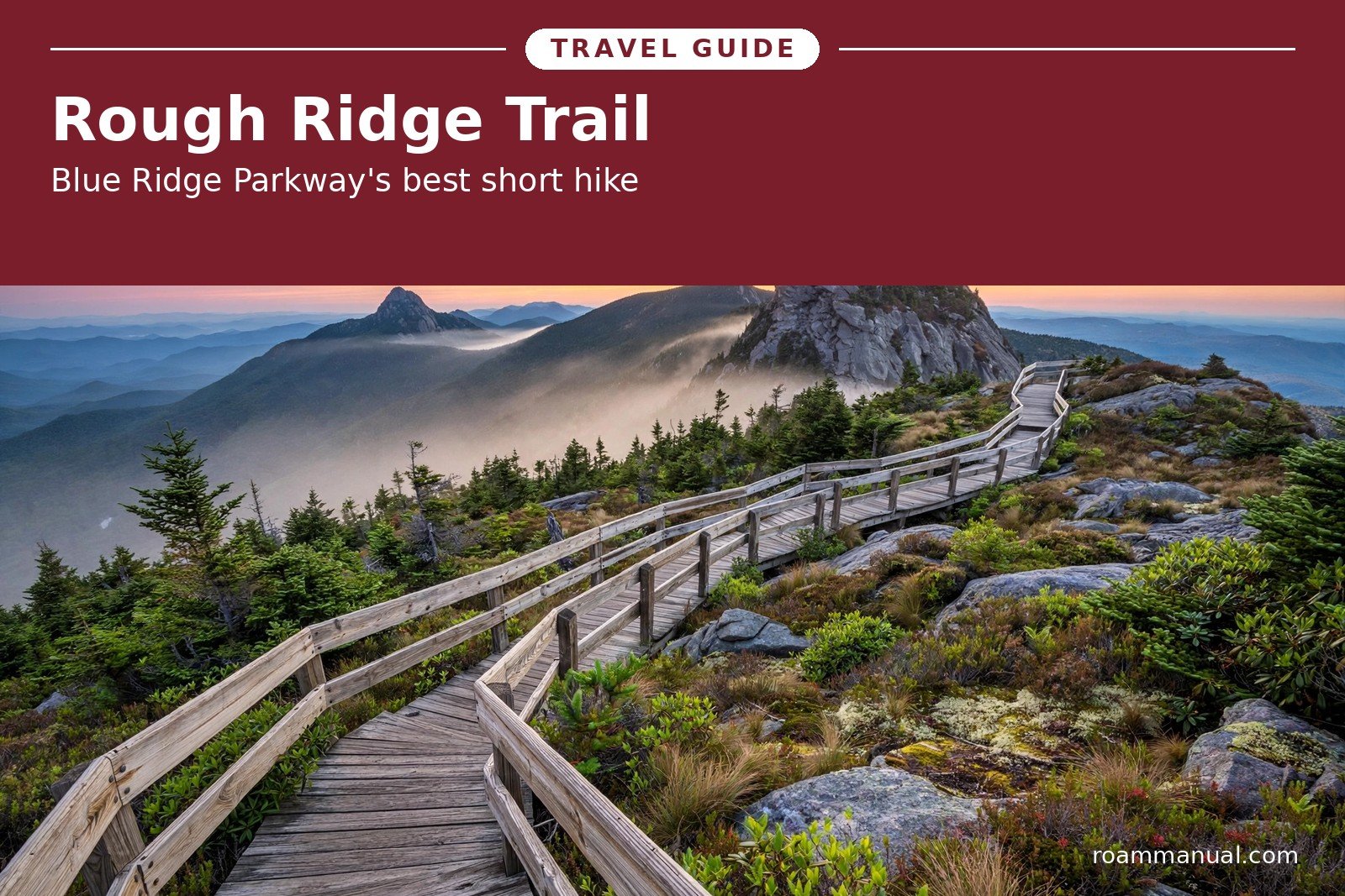
Some hikes make you work all day for one good view. The Rough Ridge Trail is not one of them.
In about 1.2 miles round trip, this short climb on the Blue Ridge Parkway delivers boardwalk paths, rugged boulders, and some of the most famous views in the High Country.
Grandfather Mountain towers nearby. The Linn Cove Viaduct curves through the forest below. Valleys stretch in every direction.
Rough Ridge sits at Milepost 302.8 on the Blue Ridge Parkway in North Carolina, in the mountains between Boone and the Linville area.
It is one short section of the 13.5-mile Tanawha Trail, but most hikers turn around at the Rough Ridge summit and walk back to the car.
The whole trip usually takes one to two hours, including plenty of time to stand on the rocks and take photos.
This hike is a natural stop on any Blue Ridge Parkway road trip guide itinerary through the northern mountains.
It asks for little and gives a lot, which is why the small parking lot fills early on sunny weekends and in October.
Rough Ridge Trail at a Glance
- Trailhead: Rough Ridge Overlook, Milepost 302.8, Blue Ridge Parkway
- Distance: 1.2 miles round trip
- Difficulty: Moderate
- Elevation gain: About 400 to 480 feet
- Time needed: 1 to 2 hours
- Trail surface: Forest path, boardwalk, wooden stairs, and bare rock
- The bigger picture: Rough Ridge is a section of the 13.5-mile Tanawha Trail
Getting to the Trailhead
Finding the trail could not be easier. The Rough Ridge Overlook parking area sits right on the Blue Ridge Parkway at Milepost 302.8, and the path leaves directly from the pavement.
No gravel roads. No hidden trailheads. Just pull in and start walking.
The nearest base towns are Boone, Blowing Rock, and Banner Elk.
Many visitors add Rough Ridge to a day of driving the northern section of the Parkway, or pair it with stops at the Linn Cove Viaduct and Beacon Heights just down the road.
One more thing to check before you drive out. The Blue Ridge Parkway closes sections of road in bad weather, and winter storms can shut down this stretch for weeks.
Check the National Park Service road closure page before you go, especially from December through March.
The trailhead has no services, so fill your gas tank and pack your food before you leave town.
The parking lot is small, and it fills fast on weekends and during fall color season. Arrive early in the morning or visit on a weekday for the best chance at a spot.
If the lot is full, wait patiently for a space instead of parking on the grass or in unsafe pull-offs.
The nearby Wilson Creek Overlook also makes a good backup plan for views without the hike.
From the Parking Lot to the Tanawha Trail
From the parking area, a short spur trail climbs uphill through the woods and meets the Tanawha Trail at a signed junction.
Turn left, following the signs toward the ridge. You will cross a small wooden bridge over a tributary of Wilson Creek.
This first part of the walk is shady and green. Ferns line the path, moss covers the rocks, and rhododendron crowds in from both sides.
The climb is steady but manageable, and the forest muffles the road sounds from the Parkway.
The Boardwalk Section
Then the trees open, and the views begin. The trail climbs a series of wooden boardwalks and staircases for about a quarter mile, and this stretch is the reason Rough Ridge looks like nowhere else on the Parkway.
The sunny, windswept ridge grows rare alpine-like plants and lichens that took thousands of years to establish. The boardwalks, stairs, and cables exist to protect them.
Stay on the boardwalk and the marked path at all times. One shortcut across the vegetation can damage growth that will not recover in your lifetime.
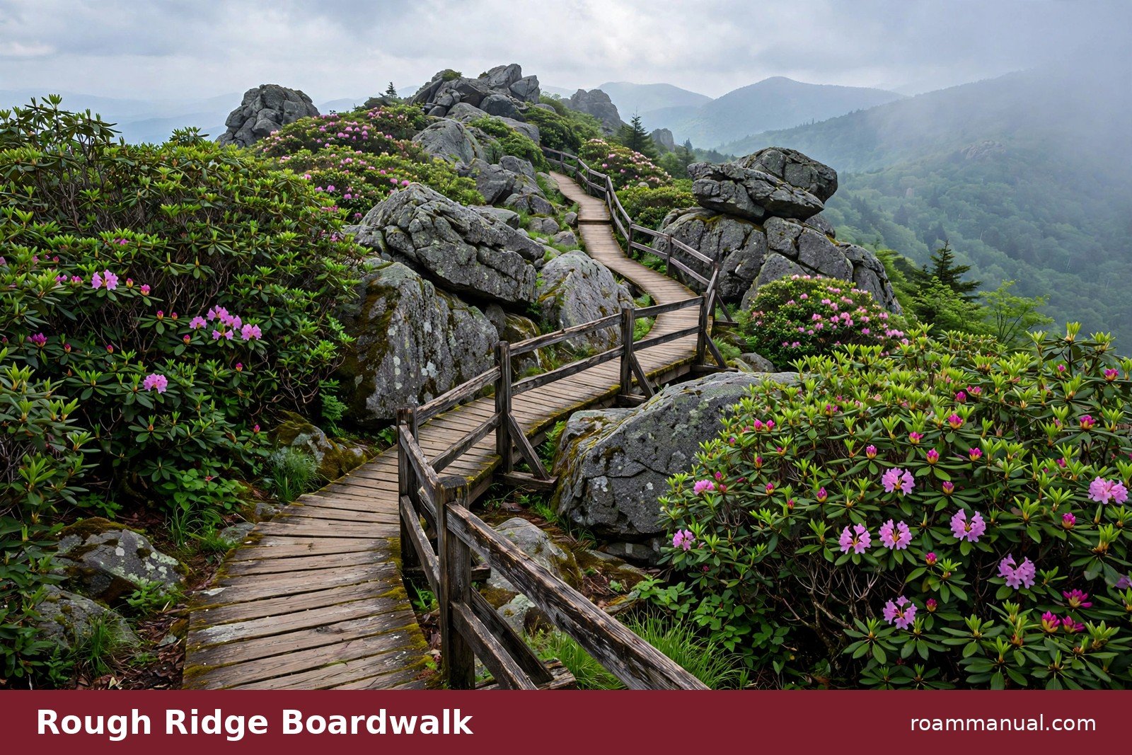
The boardwalk also makes the hiking easier than it looks. The wooden path crosses the steepest, rockiest ground, so you can focus on the views instead of your footing.
Walk slowly here. This is the most photogenic part of the trail.
Photographers love this stretch. The boardwalk lines lead the eye straight toward Grandfather Mountain, and the weathered wood looks great against the green rhododendron. Morning mist often hangs in the valleys below, which adds drama to wide shots.
The Final Climb to the Summit
Past the boardwalk, the path moves through thickets of mountain laurel and over bare rock.
The grade gets steeper here, and the trail cuts through a final set of switchbacks before reaching the summit area at just over half a mile from the parking lot.
Anchor cables mark the route to the highest rock. Use them for balance and take your time. The rock is smooth in places and can be slick after rain.
If you are not comfortable with the final scramble, stay on the lower rocks. The views from there are just as good, and nobody will fault you for skipping the top.
The Views From Rough Ridge
Grandfather Mountain dominates the view, its rugged peaks rising above the ridge. On the other side, the Linn Cove Viaduct curves through the forest below, a famous ribbon of road wrapped around the mountainside.
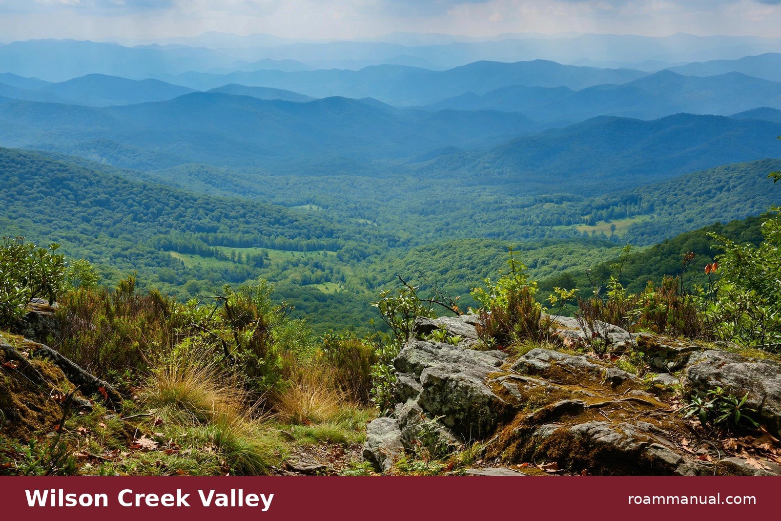
Look farther, and the views drop into the Wilson Creek valley and stretch across layer after layer of Blue Ridge peaks. On clear days the Linville Gorge country opens to the south.
The outlooks face several directions, so the scene changes with the light. Golden in the morning. Wide and blue at midday. Warm again as the sun drops.
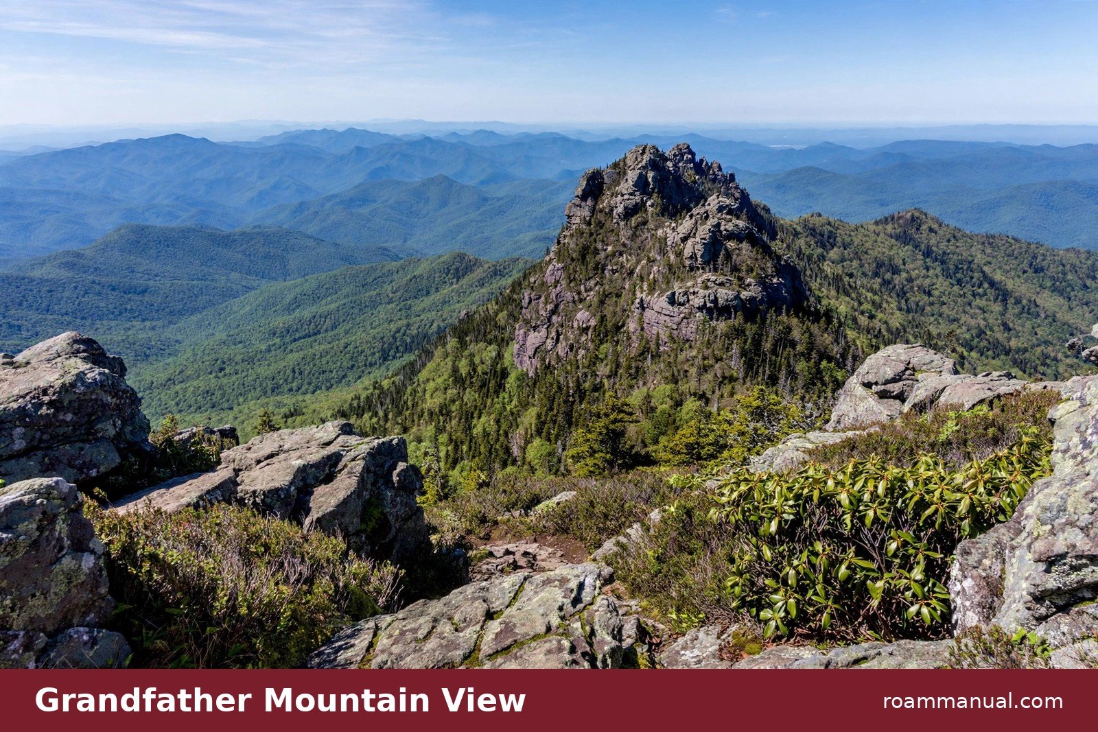
Because the summit is a cluster of rocky overlooks rather than one single platform, crowds spread out.
Walk a few yards in either direction and you will often find your own quiet perch. Bring a snack, sit down, and stay a while.
Best Time to Hike Rough Ridge
Sunrise is the best time of day for this hike. The morning light fills the valleys and lights up Grandfather Mountain, and you will likely share the rocks with only a few other early risers.
Late afternoon is the next best choice, when the light turns warm and golden.
October is the most popular month. Fall color sweeps through the High Country in waves, and Rough Ridge sits right in the middle of it.
The trail is at its busiest during peak leaf season, especially on weekends. If you hike in October, arrive before 9 a.m. or plan for a late-afternoon visit.
Each season changes the hike:
- Summer: green forests and afternoon thunderstorms. Start early and watch the sky.
- Winter: ice on the boardwalk and rocks, so check conditions and wear footwear with real grip.
- Spring: wildflowers and smaller crowds.
If you want the trail almost to yourself, pick a weekday morning in late spring or early fall. The light is soft, the parking lot is half empty, and the only sounds are wind and birds.
What to Bring and How to Stay Safe
Rough Ridge is short, but it is still a mountain hike:
- Wear shoes with good grip. The boardwalk and rocks get slippery when wet or icy.
- Bring water and a light snack, even for a two-hour trip.
- The weather on the ridge can change fast, so carry an extra layer.
Stay on the trail and the boardwalk at all times. The ridge plants are rare and fragile. Do not pick flowers, move rocks, or feed wildlife. Pack out everything you carry in.
Keep children close near the summit rocks. The edges are exposed and the drop-offs are real. Give other hikers space at the overlooks, and step aside on narrow boardwalk sections so people coming down can pass.
Keep Going: The Tanawha Trail Connection
Rough Ridge is one highlight of the Tanawha Trail, a 13.5-mile route that runs from Julian Price Park to Beacon Heights at Milepost 305.2.
From the Rough Ridge summit, the Tanawha Trail continues south toward the Linn Cove Viaduct area and on to Beacon Heights.
If you want more miles, keep walking south from the summit instead of turning back.
The Tanawha Trail is marked with white feather symbols. Follow them if you go beyond Rough Ridge, and turn around while you still have plenty of daylight.
The Parkway has no lights, so the trail gets hard to follow after dark, though it stays interesting, with more rock outcrops, forest sections, and views.
If you walk north from the Rough Ridge trailhead, the Tanawha Trail heads toward Julian Price Park.
Trails in this area can also connect toward Grandfather Mountain, where the terrain gets much steeper and more technical. Those connecting routes are strenuous. Only attempt them if you are prepared with food, water, and proper footwear.
Nearby Stops Worth Adding
Rough Ridge sits in one of the busiest and most scenic stretches of the Parkway, and it pairs well with other short stops.
Just a couple of miles south, the Linn Cove Viaduct area at Milepost 304 offers the classic view of the elevated roadway. A short, easy access trail at Milepost 304.4 leads to a viewpoint of the viaduct itself.
A few miles farther, Beacon Heights at Milepost 305.2 is another quick climb with big views from a set of east-facing cliffs. Together, Rough Ridge, the viaduct, and Beacon Heights make a perfect half-day of Parkway exploring.
For more pull-offs and photo stops along this stretch, browse the Blue Ridge Parkway overlooks guide before you go.
Key Takeaways: Rough Ridge Trail
- 1.2-mile round trip from Milepost 302.8. Allow 1 to 2 hours.
- Boardwalks and stairs cross a fragile ridge. Stay on the trail to protect rare plants.
- Best light at sunrise; best colors in October. The small lot fills early.
- Easy to pair with the Linn Cove Viaduct (Milepost 304) and Beacon Heights (Milepost 305.2).
FAQs
How long is the Rough Ridge Trail?
The Rough Ridge section is 1.2 miles round trip from the parking area at Milepost 302.8 to the summit and back. Most hikers finish in 1 to 2 hours, including time to enjoy the overlooks.
The boardwalk viewpoint is only about a third of a mile from the lot, so even a shorter out-and-back walk is rewarding.
How hard is the Rough Ridge Trail?
The trail is rated moderate. It climbs 400 to 480 feet over about half a mile, with boardwalk stairs, rocky sections, and one cable-assisted scramble at the top.
The boardwalk does a lot of the hard work for you, but the grade is real. Fit beginners can handle it with breaks.
Where is the Rough Ridge trailhead?
The trailhead is the Rough Ridge Overlook parking area at Milepost 302.8 on the Blue Ridge Parkway in North Carolina. The trail starts right from the parking lot.
Boone, Blowing Rock, and Banner Elk are the nearest towns to stay in.
Is Rough Ridge part of the Tanawha Trail?
Yes. Rough Ridge is a short, popular section of the 13.5-mile Tanawha Trail, which runs from Julian Price Park to Beacon Heights. The Rough Ridge trailhead meets the Tanawha Trail at a signed junction just uphill from the parking area.
What is the best time of day to hike Rough Ridge?
Sunrise is the best time. The morning light fills the valleys and lights up Grandfather Mountain, and the trail is at its quietest.
Late afternoon is also beautiful. Midday in summer is the most crowded and the harshest light for photos.
Is Rough Ridge good in the fall?
Rough Ridge is one of the best fall hikes on the Blue Ridge Parkway. October brings peak leaf season, and the ridge sits right in the middle of the color.
Expect the biggest crowds of the year, especially on weekends, and arrive early for parking.
Can you see the Linn Cove Viaduct from Rough Ridge?
Yes. The Linn Cove Viaduct is visible from the Rough Ridge summit and boardwalk overlooks. It curves through the forest below the ridge.
For a closer look, drive a couple of miles south to Milepost 304 and walk the short access trail at Milepost 304.4.
