




Last updated: October 1, 2026
Some of the best views on the Blue Ridge Parkway take almost no work at all.
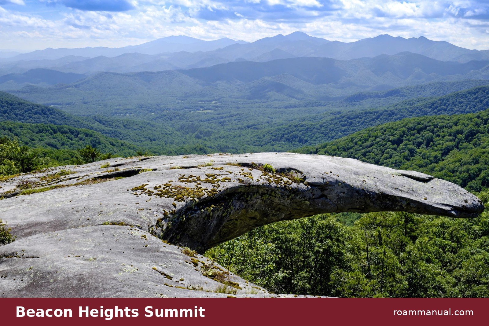
Beacon Heights sits right on the Parkway at milepost 305.2, just south of Grandfather Mountain, and it rewards hikers with wide mountain views after a short, shaded climb.
Travelers who want a big payoff without a big effort love this stop. The trail runs less than a mile round trip, and the summit holds two rocky overlooks that face different directions.
On a clear day you can pick out Grandfather Mountain, Grandmother Mountain, Linville Gorge, and peaks as far away as Mount Mitchell.
Beacon Heights also fits neatly into a longer drive through the High Country. If you are mapping out the route, our Blue Ridge Parkway road trip guide strings this stop together with the other highlights near Grandfather Mountain.
Beacon Heights Trail at a Glance
- Location: Blue Ridge Parkway, milepost 305.2, near Grandfather Mountain in Pisgah National Forest
- Distance: About 0.7 miles round trip
- Elevation gain: About 130 feet
- Difficulty: Easy to moderate
- Time needed: 30 to 60 minutes
- Surface: Packed dirt, rocks, and roots
- Trailhead parking: Free lot at milepost 305.2, elevation about 4,220 feet
- Dogs: Allowed on a leash
Getting to the Trailhead
Beacon Heights is one of the easiest trailheads to find on this stretch of the Parkway.
The parking area sits directly on the road at milepost 305.2, a few minutes south of the Grandfather Mountain entrance road and the junction with US 221.
The drive itself is part of the reward. This section of the Parkway winds along the eastern slopes of Grandfather Mountain and passes the Linn Cove Viaduct, the famous S-curved bridge that clings to the mountainside.
Coming from Asheville, the trailhead sits about 80 miles north along the Parkway.
Parking is free, and the lot sits high at about 4,220 feet. On quiet days you can park with no trouble.
On October weekends the small lot fills early, so arriving before 10 a.m. gives you the best shot at a spot.
If the lot is full, drive on to another stop and circle back in the late afternoon when the morning crowds thin out.
Here is a nice bonus: Grandfather Mountain rises above the treeline right from the parking area. Even visitors who skip the hike get a view worth the drive.
Many people stop for a few minutes at the lot, take photos, and then decide to walk the trail after all.
Before you go, check the NPS site for Parkway closures. Storm damage and winter weather can shut sections of the road, and this high stretch gets early snow in some years.
The Hike: Forest, Rocks, and Roots
The trail starts at the east side of the parking lot. You cross a gravel road, then the path dips into the forest and begins to climb through hardwoods.
This trailhead is a junction of several long-distance routes, so pay attention to the blazes. The feather-blazed Tanawha Trail heads left and runs north toward the Linn Cove Viaduct and Rough Ridge.
The white circular blazes of the Mountains to Sea Trail share the first stretch of the climb as well.
For Beacon Heights, follow the path that climbs through a rocky, rooty forest filled with moss-covered boulders, ferns, and gnarled rhododendron.
At about two-tenths of a mile, the Mountains to Sea Trail splits right. Stay left and keep climbing over large, weathered rock outcrops toward the summit.
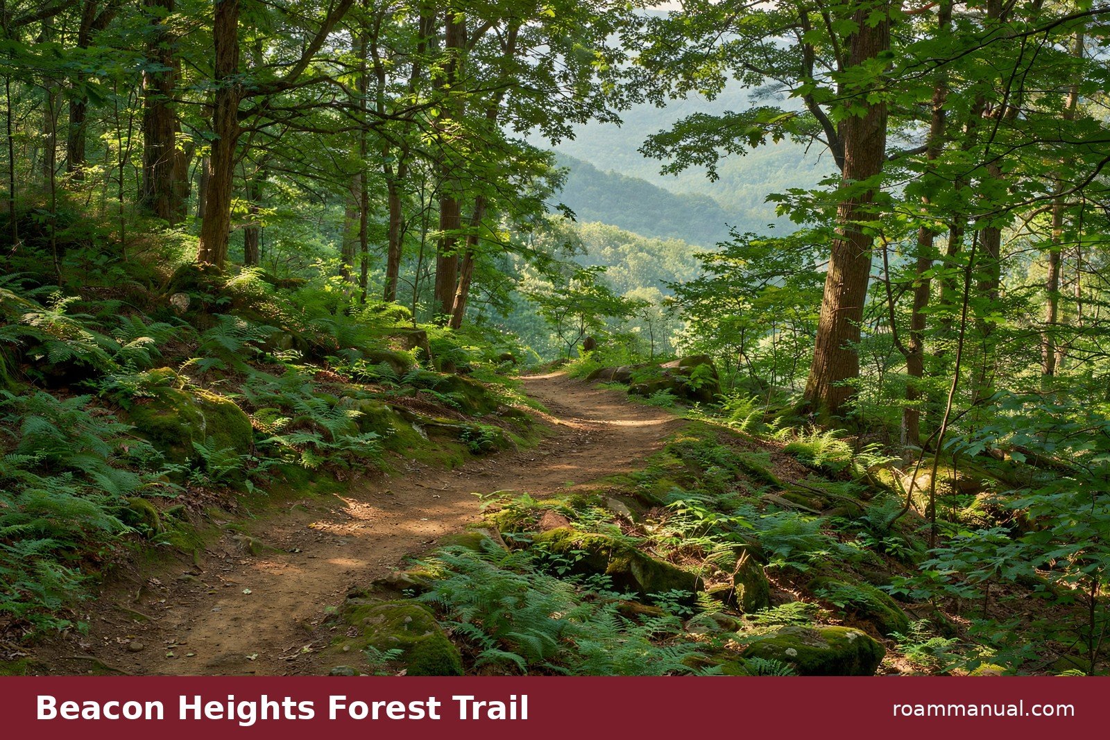
The tread is easy to follow, but it is not a smooth path. Rocks and roots crowd the trail in places, and the rock sections can get slick after rain.
Sturdy shoes with real tread make the short climb far more comfortable than flat sneakers or sandals.
The climb is short but steady. Most hikers reach the summit area in 15 to 20 minutes at a relaxed pace.
Families hike this trail often, and kids generally handle it well when they take their time on the rocky stretches.
Give yourself at least half an hour for the full visit, since the views at the top invite a long pause.
The Two Summit Overlooks
Near the top, the trail splits to visit two separate rocky overlooks. Hike both of them. They sit close together, and each one faces a different direction.
The Southern Overlook
Most hikers visit the southern overlook first. It is a wide, open rock slab that faces south and east across the Wilson Creek valley.
Grandmother Mountain stands closest, with its antenna-topped summit easy to pick out from the crowd of ridges.
On clear days the view runs much farther than the nearest peaks. Look south to spot Table Rock and the steep walls of Linville Gorge.
Farther still, the dark ridgeline of Mount Mitchell, the highest point in the eastern United States, sits on the horizon.
The southern overlook has room to spread out, which makes it one of the best picnic spots on this stretch of the Parkway.
The Northern Overlook
Backtrack to the junction and head north to the second overlook. The trail leaves the low tree cover and opens onto a wide, gently arced summit studded with boulders and shallow depressions that collect rainwater.
This is the Grandfather Mountain view, and it is the one people remember. The mountain’s sharp, angular ridge fills the northwest horizon, rising high above the Parkway.
It is one of the most dramatic views of Grandfather you can get without paying the entrance fee at the mountain park, and on a blue-sky day it stops hikers in their tracks.

What You Can See From the Top
Beacon Heights faces multiple directions, so the summit works like a grand tour of the High Country. From the two overlooks you can pick out:
- Grandfather Mountain to the northwest, with its craggy, angular profile
- Grandmother Mountain to the south, topped with communications antennas
- Linville Gorge and Table Rock Mountain to the southeast
- Mount Mitchell on the distant southern horizon
- The Wilson Creek valley spreading out below the eastern cliffs
The layered ridgelines are the real show. The Blue Ridge gets its name from the blue haze that trees release into the air, and Beacon Heights shows that color better than almost any stop at this elevation.
For a drive-up payoff, it ranks among the most rewarding Blue Ridge Parkway overlooks in the Grandfather Mountain area.
Key Takeaways for Beacon Heights Trail
- The Beacon Heights Trail sits at Blue Ridge Parkway milepost 305.2, just south of Grandfather Mountain.
- The hike runs about 0.7 miles round trip with roughly 130 feet of elevation gain.
- Two rocky summit overlooks face different directions: Grandfather Mountain to the north, Grandmother Mountain and Linville Gorge to the south.
- Parking is free, but the small lot fills early on October weekends, so arrive before 10 a.m.
- Wear sturdy shoes, pack water and a snack, and check Parkway closures before you go.
Difficulty and Trail Surface
Call it easy to moderate. The distance is short and the elevation gain is only about 130 feet, which most hikers handle with ease.
What adds the “moderate” part is the rocky, rooty tread and a few short steeper pitches near the summit.
Kids do well here with supervision, and leashed dogs are welcome on the trail. The rocks can be slippery when wet, so save this one for a dry day if you hike with small children or older relatives.
There are no guardrails at the overlook edges, so keep kids and dogs close at the top and stay on the solid rock.
This is a good trail for beginners who want to build confidence. The route is short enough to bail out easily, clearly blazed, and never far from the Parkway.
If you have only hiked flat park paths before, the rocky sections here are a gentle introduction to mountain terrain.
Best Time to Visit
October is the star season at Beacon Heights. The parking area sits at about 4,220 feet, so fall color usually peaks here in mid-October.
The forest along the trail turns gold, orange, and red, and the views from the overlooks fill with color in every direction.
Expect company in October. This is one of the most popular short hikes near Grandfather Mountain, and fall weekends bring the biggest crowds of the year.
Weekday mornings are the calmest time to visit. Sunrise from the overlooks is spectacular if you arrive early enough to beat the line of cars.
Summer brings green shade and afternoon thunderstorms. If you hike on a summer afternoon, plan to be off the exposed rock well before storms build, since the summit has no shelter.
Spring offers wildflowers along the trail, and winter hikes are possible when the Parkway stays open, though ice can make the rock outcrops treacherous.
Sunrise, Sunset, and Photos
Beacon Heights works for both ends of the day. The southern overlook faces east across the Wilson Creek valley, which makes it a natural sunrise spot.
Early light washes across the ridges in gold and pink, and you may have the summit to yourself.
For sunset, the northern overlook is the better bet. Grandfather Mountain glows in warm light from the northwest horizon, and the layered ridges fade into purple as the sun drops.
Photographers should bring a tripod if they plan to stay past golden hour, since the walk back is short but rocky.
The rock surfaces at both overlooks make fine platforms for a tripod or a steady phone shot. Just keep a safe distance from the edges, especially when the rock is wet or icy.
Pairing Beacon Heights With Nearby Stops
Beacon Heights earns a place in any Blue Ridge Parkway road trip guide because it sits so close to the other big stops on this stretch. You can stack several highlights into one morning without any long drives between them.
Head a few miles north on the Parkway to reach Rough Ridge, where a 1.2-mile round-trip walk on the Tanawha Trail leads to boardwalk and boulder viewpoints on the lower slopes of Grandfather Mountain.
The same Tanawha Trail continues to the Linn Cove Viaduct, the famous S-curved bridge that hugs the mountainside.
Stringing Beacon Heights, Rough Ridge, and the Viaduct together makes for one of the finest short stretches on the entire 469-mile Parkway.
Grandfather Mountain itself sits just up the road, with its Mile High Swinging Bridge and a network of longer trails for hikers who want more.
For visitors who have spent the morning at the mountain park, Beacon Heights makes a perfect free leg-stretcher before lunch in Linville or Boone.
Tips for a Smooth Visit
- Arrive early. The parking lot is small and fills fast on fall weekends. Aim for before 10 a.m., or try late afternoon.
- Wear real shoes. The trail is rocky and rooty, and the summit rock gets slick in the rain. Hiking shoes or trail runners beat flip-flops by a mile.
- Pack water and a snack. The hike is short, but the overlooks invite you to linger. A picnic at the southern overlook is a local favorite.
- Check Parkway status. Closures can affect this stretch in winter and after storms. The NPS posts current conditions online.
- Leave no trace. Pack out everything you bring, stay on the marked path, and keep the overlooks clean for the next hikers.
- Visit both overlooks. The northern and southern overlooks face different directions, and skipping one means missing half the view.
FAQs
How long is the Beacon Heights Trail?
The hike runs about 0.7 miles round trip from the trailhead at milepost 305.2 to the summit and back. Most hikers finish in 30 to 60 minutes, including time to enjoy both overlooks.
Fast hikers can be back at the car in under half an hour.
Is the Beacon Heights Trail hard?
Most hikers rate it easy to moderate. The distance is short and the elevation gain is only about 130 feet.
The moderate rating comes from the rocky, rooty tread and short steeper pitches near the top. Wear sturdy shoes, take your time on the rocks, and it feels easy.
Where do I park for the Beacon Heights Trail?
The trailhead parking lot sits directly on the Blue Ridge Parkway at milepost 305.2, near the Grandfather Mountain entrance road. Parking is free.
The lot is small and fills early on October weekends, so arrive before 10 a.m. or visit on a weekday for an easier spot.
Can you see Grandfather Mountain from Beacon Heights?
Yes. The northern overlook faces northwest toward Grandfather Mountain, whose sharp, angular ridge dominates the horizon.
You can even see the mountain from the parking lot before you start hiking. The summit also offers views of Grandmother Mountain, Linville Gorge, Table Rock, and Mount Mitchell.
What is the best month to hike the Beacon Heights Trail?
October is the best month for most visitors. At 4,220 feet, fall color at Beacon Heights usually peaks in mid-October, and the views from the overlooks are at their most colorful.
Summer is green and shaded, while spring brings wildflowers. Winter hikes are possible when the Parkway is open, but ice can make the summit rock dangerous.
Are dogs allowed on the Beacon Heights Trail?
Yes, leashed dogs are welcome on the trail. It is a popular hike for families with kids and dogs. Keep dogs leashed at all times, especially near the unguarded edges of the overlooks, and pack out all waste.
How is Beacon Heights different from Rough Ridge?
Both are short hikes off the Parkway near Grandfather Mountain, and both share the Tanawha Trail corridor.
Beacon Heights is shorter and easier at about 0.7 miles round trip, with two summit overlooks facing different directions.
Rough Ridge is a 1.2-mile round trip farther north, with boardwalk sections and boulder outcrops on Grandfather Mountain’s lower slopes. Many visitors hike both in one morning.
